")
Mistrial Declared in Sexual Abuse Case Against Former Thoreau MS Teacher — A Fairfax County Circuit Court jury acquitted Matthew Snell on one count of inappropriate sexual relations with a teenager after 13 hours of deliberation. The jury failed to reach a verdict on two other charges, likely prompting a retrial. [The Washington Post]
Tysons Auto Investment Company Sold — Investment firm Ares Management Corp. closed a $3.8 billion deal yesterday (Thursday) to acquire Capital Automotive Real Estate Services Inc., which gives financing to automobile dealers for buying new locations and upgrading facilities. Based at 8484 Westpark Drive, the company has recently been selling land that it owns for the Dominion Square West development. [Washington Business Journal]
Tysons Steakhouse Plans Second Fairfax County Location — The Brazilian steakhouse Fogo de Chão plans to open a new location in Reston Town Center this spring. The company’s restaurant outside of Tysons Galleria is the only one it currently has in Northern Virginia. [Reston Now]
Funding Recommended for Local Transportation Projects — The National Capital Region Transportation Planning Board approved a $7.2 million plan on Wednesday (Feb. 16) to support bicycle and pedestrian infrastructure upgrades. The recommendations include the Vienna Metro station bicycle improvements and Shrevewood Elementary School Safe Routes to Schools project requested by Fairfax County. [WTOP]
Vienna Nepali Restaurant Gets Thumbs Up — “You will not find a dish quite like Royal Nepal Bistro’s fulbari naan in its homeland. Yes, co-owner Sunil Chaudhary says that the breads in parts of southern Nepal are sweet, but this creation exists only in Vienna.” [Northern Virginia Magazine]
")
(Updated at 4:25 p.m.) The Fairfax County Department of Transportation got an initial round of public input last week on its study to improve pedestrian and bicycle safety and infrastructure in the area around the West Falls Church Metro station.
The department held virtual meetings on Wednesday and Saturday (Feb. 9 and 12) on the study as the county hopes to address community concerns before developers begin to transform the 24-acre transit station area, attracting more foot and vehicle traffic to the area.
FCDOT planner Timothy Kutz Jr. explained that the study focuses on a 2-mile radius around the Metro station to find gaps in the bicycle network. The study’s scope also encompasses a 1-mile radius for possible pedestrian improvements.
After the presentation, attendees brought up a range of issues, from missing sidewalks to the need for safer crossing methods. Areas of concern included access to the Metro station and nearby Haycock Elementary School, among other destinations.
One example of the need for increased safety was Redd Road, where participants raised concerns about the lack of sidewalks and safe crossing points as well as potential traffic dangers.
According to the study description, improvements there could include a walkway and a bridge that would connect to Redd from both the Idylwood Road and Pimmit Drive sides of the street.
Attendees also questioned if the planned development will make local traffic denser and more hazardous.
“We will be looking at forecasted volumes on select streets in order to determine how a change in traffic given increased development may affect the recommendations we make for active transportation improvements,” Kutz said.
The county launched the study in December after the Board of Supervisors approved comprehensive plan changes in July to allow mixed-use development around the West Falls Church Metro station and the Virginia Tech campus.
The plan allows for a maximum of 1,340 residential units, 301,000 square feet of office space, 48,000 square feet for retail space, and 160,000 square feet for institutional needs.
According to the project’s draft scope of work, the first set of recommendations will be ready to present for community feedback sometime this spring. A final draft of the study is projected to go before the Board of Supervisors in the summer.
Photo via Google Maps

For all its transit-friendly aspirations, Tysons remains decidedly car-oriented. Take the seven-lane gauntlet that is Route 7 (Leesburg Pike), where evening rush-hour backups can extend for blocks and crosswalks feel like dares.
With uprooting one of the region’s major thoroughfares presumably out of the question, state and local transportation staff hope to at least improve the situation with an ongoing study of Route 7 between Route 123 (Chain Bridge Road) and I-495.
In partnership with Fairfax County, the Virginia Department of Transportation is now seeking input on ways to minimize crashes, relieve congestion, and improve pedestrian and bus facilities in the corridor.
The online survey is open through Feb. 16, as officials finalize a plan to address safety and traffic issues.
State officials suspect congestion is a primary factor in numerous crashes. From 2015 to 2019, this stretch of road saw five crashes resulting in severe injuries, 90 other injuries, and 141 more incidents involving property damage.
Possible solutions include removing service roads and adding a shared-use path for pedestrians and cyclists, upgrading crosswalks and curbs, and widening a median for future bus rapid transit or BRT lanes.
The study is part of a new Project Pipeline launched last year by the Commonwealth Transportation Board that seeks to streamline high-priority projects. With the program, officials will prioritize limited funding for a handful of projects in the state, including Route 7.
The improvements recommended by the study will tie into plans to widen Route 7 to accommodate express bus lanes, according to Allan Fye, the Northern Virginia Transportation Commission’s director of programs and policy.
“[These] efforts support the ultimate goal to provide high-quality, high-capacity BRT service along the Route 7 corridor,” he said in an email.
Plans to bring dedicated bus lanes to Tysons have been in the works for years.
The Fairfax County Board of Supervisors approved a BRT route last July that’s being incorporated into NVTC’s larger effort to develop a bus service from the Spring Hill Metro station to Alexandria’s Mark Center.
The Envision Route 7 planning process began in 2013 and moved into its fourth phase in October with a mobility study looking at the proposed route from Tysons to Seven Corners. The study is expected to be complete by June 2023.
“NVTC has and continues to work closely with [the Fairfax County Department of Transportation] and VDOT,” Fye said. “Our close coordination allows us to leverage each other’s work to advance the overall BRT project while providing strategic opportunities to advance key segments that may allow service to begin in phases.”
After collecting public input from the Project Pipeline survey, VDOT will examine how to fund the upgrades from March to July this year.
Photo via VDOT

Fairfax County is looking for $7.3 million to help create two links for the upcoming I-66 trail.
The county’s Board of Supervisors gave the go-ahead on Tuesday (Jan. 25) for its transportation director to apply for the funds via the Northern Virginia Transportation Commission.
One of the links is a 5,000-foot-long cycle track along Country Creek Road/Virginia Center Boulevard and a 10-foot-wide paved path along Sutton Road near the Vienna Metro station. The connection would run from the Nutley Street interchange to Blake Lane.
“Funding will assist in completing a high-quality, long-distance active transportation route along the I-66 corridor, conveniently connecting a large segment of Fairfax County population to transit facilities, employment centers, recreational destinations, and other jurisdictions,” county staff said in the board meeting package.
It’s part of the I-66 trail and the application serves as an integral connection, Fairfax County Department of Transportation spokesperson Robin Geiger said.
FCDOT confirmed the project had been unsuccessfully submitted for funding from NVTC before. It previously received a score of 47 out of 100, and the transit group advanced higher-scoring transit proposals.
Geiger said it’s common for funding requests to be renewed, though.
The trail is part of a package of projects that the board sent to NVTC for consideration in the fifth round of its I-66 Commuter Choice program, which funds transit and capital improvement projects in the corridor using highway toll revenues.
Another NVTC funding application the county agreed to seek was $4.3 million for an I-66 trail segment that would cover a 2,750-foot-long portion from the Monument Drive commuter parking garage to the West Ox Road transit center.
Additionally, the board approved seeking $1.2 million in funding to help continue funding Express Route 698 connecting the Vienna and Pentagon Metro stations and $2.2 million to increase bus service on that route.
Funding decisions for the fiscal year 2023-2024 I-66 Commuter Choice program could be announced in May from NVTC, followed by the Commonwealth Transportation Board in June. Virginia’s fiscal year starts on July 1.
Photo via VDOT
")
The Fairfax County Board of Supervisors has submitted plans for its Tysons Fire Station and Bus Transit Facility project.
As shared at a public meeting in November, the project will relocate Fire Station 29 from Spring Hill Road to the 8300 Jones Branch Drive site now occupied by Fairfax Connector’s West*Park Transit Station, which will be replaced with a smaller, one-story building with offices and a commuter waiting area.
The new two-story, 20,000 square-foot fire station will have a garage with five engine bays as well as storage and administrative space, including offices, a kitchen, an exercise room, and bunk rooms for workers.
With Tysons becoming more populous and developed, county leaders say the station is needed to meet anticipated future demand for emergency services.
“The existing station is 3-bay only, outdated and having limited room on site for expansion,” a statement of justification said. “This project provides the opportunity to serve the Tysons area with a 5-bay fire station, replacement transit station and a new access to the [Dulles Toll Road].”
To build the facilities, the county board wants to remove the 4.2-acre parcel from a proffer agreement with a developer that limited its use to a bus station, kiss-and-ride lot, or mass transit facility, according to the application submitted on Jan. 4.
In response to traffic circulation concerns raised by some county staff, project manager Jun Li said that maintaining a clear separation between vehicles and pedestrians has been a design priority.
")
The overhauled site is expected to produce fewer trips during peak hours than it does now, because the number of bus bays for passenger loading will be reduced from seven to five, and shift changes for fire station personnel will occur outside of peak hours.
A traffic study approved by the county and state transportation departments estimated that the fire station will see a total of four trips per hour, based on projections of how many calls the Fairfax County Fire and Rescue Department will receive in the area.
The proposed plan allocates 46 parking spaces to the fire station and eight spaces for the bus facility, including two spaces each designated for people with disabilities. The transit station currently has 40 parking spaces total.
According to Li, the new bus facility is envisioned more as a transfer station, rather than a park-and-ride lot, so the county doesn’t anticipate a lot of cars or bicycles at the site.
However, the county is considering adding a shared bicycle and pedestrian lane along Jones Branch Drive and has committed to providing 8-foot-wide sidewalks on Jones Branch and Spring Hill Road.
The facility will feature electric charging stations for both buses and cars. The county hopes to reduce energy and carbon emissions by at least 30%.
“We are also in process of studying net zero,” Li wrote.
The application notes, though, that the project as proposed would eliminate all existing tree cover.
“As the project moves along, more effort will be investigated for preserving the tree canopies as much as possible when getting into design details,” the statement of justification says. “Given the lack of tree preservation, the balance of the tree canopy cover requirement would need to be met with new on-site tree planting.”

Eastbound drivers on I-66 can expect overnight delays this week as crews demolish the old Gallows Road bridge in Merrifield.
Crews are taking apart an old concrete deck with jack hammers, saw cutters, and hoe rams. The overnight work began last night (Sunday) and will repeat each night through Jan. 16.
A new Gallows Road bridge opened to traffic in October as part of the Transform 66 Outside the Beltway project, which is adding express lanes, upgrading interchanges, replacing bridges, and improving pedestrian routes along 22 miles of the interstate from I-495 in Dunn Loring to Gainesville.
The hazardous conditions mean that three lanes on I-66 are closed to eastbound traffic starting at 10 p.m. each night this week. They will reopen at 5 a.m. on weekdays and 7 a.m. on the weekend.
“Drivers should expect periodic stoppages of up to 20 minutes nightly Sunday through Thursday between 11 p.m. and 4 a.m., and Friday and Saturday between 11 p.m. and 6 a.m.,” the Virginia Department of Transportation said in a news release.
Gallows Road will remain open, but there will be traffic shifts at times, and changes could occur. VDOT noted that people can receive project updates via email by signing up on its website.
The new Gallows Road bridge, which currently has four lanes, will eventually shift to just a northbound link over I-66. Once crews finish the demolition work, a new southbound bridge will be built.
“The bridge will include three lanes southbound and two lanes northbound (with width to add a third northbound lane in the future),” Justin McNaul, with the engineering consulting firm ATCS that’s assisting VDOT, said in an email.
The new bridge will be longer and wider than its predecessor. It will also feature 5-foot-wide bicycle lanes in each direction with a sidewalk to the north and barrier-separated path to the south in an effort to improve access, including to the Dunn Loring-Merrifield Metro station.
The bridge is slated to be completed in the fall, and the new I-66 express lanes are expected to open in December.

The McLean Citizens Association (MCA) will weigh in tonight (Wednesday) on the bicycle and pedestrian safety projects that it believes Fairfax County should fast-track.
The Fairfax County Board of Supervisors set a goal on Oct. 5 of spending at least $100 million on bicycle and pedestrian infrastructure improvements through June 30, 2027, stating that federal relief funds have given the county some flexibility to make one-time investments.
In an email to members, MCA says Dranesville District Supervisor John Foust has asked for its help identifying priorities for McLean, as county leaders consider which projects to potentially fund and expedite.
MCA’s transportation committee has identified 14 projects in a draft resolution that its board of directors could vote on during a virtual meeting at 7:30 p.m. President Rob Jackson said changes to those plans could occur, but he suggested proposals should be done so before the meeting to build support.
“Even assuming the $100 million is split evenly among the nine Magisterial Districts, our priorities complete [sic] with projects in the Herndon and Great Falls areas,” Jackson noted in an email. “So, the Committee’s prioritizations and rationale for those priorities are critical.”
The projects would be in addition to the county’s ActiveFairfax Transportation Plan and other existing county efforts.
In its draft resolution, MCA’s transportation committee cites demand, safety concerns, and connectivity to public transit and schools as factors it considered when choosing projects to designate as priorities.
High Priority Projects
Most of the projects are near Haycock Elementary and Longfellow Middle schools, which the resolution says suffer from cracks and bulges on area sidewalks.
In addition to proposing sidewalk repairs along Westmoreland Street between Gordon Avenue and Haycock Road, the draft resolution focuses on possible improvements north of Haycock Road:
- Repairs to an asphalt trail between Westmoreland and Great Falls Street
- Widening the concrete sidewalk by 1 foot on the bridge over I-66 to accommodate pedestrians walking side-by-side or going in opposite directions
- An engineering study looking at options to make the walkway between the I-66 bridge and Great Falls Street consistently 5 feet in width, reduce sloping, and add a painted crosswalk across the Turner Avenue intersection
Other key projects included in the draft resolution address concerns to the north end of McLean:
- Study a potential pedestrian bridge across Dolley Madison Boulevard and other safety upgrades, such as traffic beacons at the Ingleside Avenue or Elm Street crosswalks
- Repair an asphalt trail along Balls Hill Road between Thrasher Road and Heather Hill Lane
The seventh high-priority project is to construct a sidewalk near Lemon Road Elementary School on Redd Road from Idylwood Road to Reddfield Drive in Pimmit Hills.
Secondary Projects Identified
The resolution also includes a list of secondary projects that MCA would like the county to pursue when possible:
- Repair portions of an asphalt trail along Dolley Madison Boulevard between Old Dominion Drive and Lewinsville Road
- Maintain and upgrade asphalt trail along Georgetown Pike just east of Dead Run Creek
- Repair an asphalt trail along Douglass Drive from Georgetown Pike to Father John Court
- Construct sidewalks along the north side of Birch Road from Birch Grove Court to Kirby Road and on Linway Terrace from the intersection of Old Dominion and Birch
- Create a trail along Lewinsville Road between Swinks Mill Road and Bridle Path Lane
- Conduct a study of a potential trail along the south side of Old Dominion between Balls Hill and a bridge over I-495
Photo via Google Maps
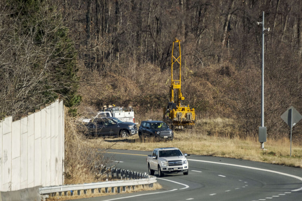
The groundwork is being laid for construction to begin next year on the Capital Beltway Express Lanes’ expansion into McLean.
A surveyor told Tysons Reporter yesterday (Tuesday) that a site boring crew has started collecting soil samples for the I-495 Extension (495 NEXT) project, which will add toll lanes on the interstate from the Dulles Toll Road in Tysons to just south of the American Legion Bridge.
The Virginia Department of Transportation confirmed that some preliminary activities have commenced, though the project’s design and construction contract are still in the process of being finalized.
“Early works are approved to proceed and are currently underway along the 495 NEXT project corridor,” VDOT spokesperson Michelle Holland said by email. “These activities include survey work, conducting a tree inventory (which involves marking trees), identifying utility locations, and doing geotechnical borings.”
GW Parkway Rehabilitation Announced
VDOT says it does not expect 495 NEXT to be affected by the National Park Service’s recently unveiled plans to revamp the George Washington Memorial Parkway, even though the projects literally intersect.
The U.S. Department of the Interior, which includes the park service, announced on Dec. 7 that it has awarded a $161 million contract to rehabilitate the parkway’s northern section from Sprout Run in Arlington to the I-495 interchange in McLean.
While the GW Parkway’s southern section has been upgraded in parts over the past three decades, this will be the first major rehabilitation of the eight-mile north section since it opened in 1962. It has been in the works since 1999, per an environmental assessment from March 2008.
After putting the project on hold “due to public and agency concerns,” the NPS restarted the planning process in 2016 and got a revised environmental assessment approved in September 2018, according to project documents. Read More
With plans to develop the West Falls Church Metro station area now in place, Fairfax County has decided to evaluate how to improve the surrounding transportation network so it can actually accommodate the anticipated growth.
The Fairfax County Department of Transportation will kick off a West Falls Church Active Transportation Study at 7 p.m. today (Monday) with the first meeting of a new citizens’ advisory group.
The study will focus on the pedestrian and bicycle infrastructure in and around the West Falls Church Transit Station Area, which is bounded by I-66, the Dulles Toll Road, Haycock Road, and the Falls Church City border near Route 7.
“The ultimate goal of the study effort will be to improve pedestrian and bike access and safety around the Metro station,” Dranesville District Supervisor John Foust said by email. “To the extent located in the study area, safe access to several schools, including Lemon Road and Haycock [elementary schools] in the Dranesville District, will also be considered.”
The Fairfax County Board of Supervisors directed staff to create an active transportation plan in July after approving an amendment to the county’s comprehensive plan that allows more mixed-use development in the West Falls Church TSA.
While Virginia Tech halted plans to redevelop its West Falls Church campus earlier this year, the Washington Metropolitan Area Transit Authority officially signed an agreement with developers in August to bring over 1 million square feet of residential, retail, and office space to the TSA.
Coupled with Falls Church City’s impending West Falls project, the development could draw an influx of residents and traffic that has community members pushing the county to address existing safety challenges and enhance streets and sidewalks not built to support the increased density.
The West Falls Church Active Transportation Study will identify possible projects to improve safety, accessibility, comfort, and connectivity for bicyclists, pedestrians, and other non-motorized travelers, according to a draft scope of work.
In addition to providing “multiple opportunities for community input,” county staff will conduct an assessment of existing facility gaps and barriers to access in conjunction with the 13-person advisory group, which will consist of:
- Three representatives each from the Dranesville and Providence districts
- Two representatives each from Dranesville and Providence school PTAs in the study area
- One representative each from the McLean Citizens Association, Providence District Council, Fairfax Alliance for Better Bicycling, and Fairfax Families for Safer Streets
The citizen group will be assisted by a technical advisory group with local and state transportation, schools, parks, and police officials as well as one representative each from Metro, the City of Falls Church, and Virginia Tech.
Noting that the study will encompass both sides of Route 7, Foust points to Haycock Road between Great Falls Street and the Metro station as one area he anticipates will get a lot of attention.
“The sidewalk is very narrow and needs to be improved,” he said. “I also expect [the advisory group] will identify many intersections where we need to improve pedestrian and bicycle safety.”
A tentative timeline for the study has an initial public meeting taking place this winter, followed by the completion of the existing conditions assessment in the late winter or early spring. A final report with recommendations is scheduled to go to the Board of Supervisors in summer 2022.
Foust says the study will establish priorities among the identified projects, which could be funded privately through the county’s rezoning process or compete for public money.
")
Local Libraries Get More COVID-19 Tests — Fairfax County Public Library started distributing an additional 10,000 COVID-19 rapid testing kits yesterday (Wednesday) afternoon after its initial batch ran out in an hour on Friday (Dec. 3). The system is now advising people to only take a kit if they need one immediately, since the tests expire at the end of December. [FCPL/Twitter]
First-Ever GW Parkway Overhaul Planned — “The National Park Service announced [Monday] that it had awarded a $161 million contract to rehabilitate the Parkway from Spout Run in Arlington to the Capital Beltway in McLean. After a design process in 2022, construction is expected to take place between 2023 and 2025.” [ARLnow]
Dolley Madison Library Display Criticized — FCPL removed a display from McLean’s Dolley Madison Library that featured the books “Gender Queer” and “Lawn Boy” alongside the Bible after resident Stacy Langton complained. Langton previously got Fairfax County Public Schools to pull the two LGBTQ-focused books from their libraries until they were reinstated last month after a review. [Associated Press/WTOP]
Vienna Approves Surplus Fund Allocations — “The Vienna Town Council on Dec. 6 unanimously approved a budget carry-forward that will allot $280,000 for a fiscal year 2023 real-estate-tax decrease, $270,000 to address employee turnover and retention, and $120,000 to correct pay compression the does not differentiate sufficiently based on employees’ work experience or skill levels.” [Sun Gazette]
Supreme Court Shares Possible Redistricting Map — “One of Virginia’s two battleground congressional districts would become a safe Democratic seat in the midterms under a redistricting proposal released by the state Supreme Court late Wednesday afternoon — but it has been moved completely into another region of the state.” [The Washington Post]