")
The National Weather Service issued Flash Flood Watch for Fairfax County and surrounding areas just days after major flooding hit.
The watch is in effect from 2 p.m. through late tonight (July 11).
More from NWS:
* Showers and thunderstorms are expected this afternoon and evening. Torrential rainfall may lead to totals exceeding 2 inches in a short period of time. This may cause flash flooding of small streams and other poor drainage urban areas.
PRECAUTIONARY/PREPAREDNESS ACTIONS…
A Flash Flood Watch means that conditions may develop that lead to flash flooding. Flash flooding is a very dangerous situation.
You should monitor later forecasts and be prepared to take action should Flash Flood Warnings be issued.
After more than 55 water rescues on Monday, forecasters are also reminding people to “turn around, don’t drown” when encountering water of unknown depth on the roads.
A Flash Flood Watch has been issued for areas in green from 2pm through tonight. 2+ inches of rainfall in a short period of time is possible. This could cause flash flooding of streams and other poor drainage urban areas. Remember, turn around, don't drown! pic.twitter.com/UqGQa0Hhla
— NWS Baltimore-Washington (@NWS_BaltWash) July 11, 2019
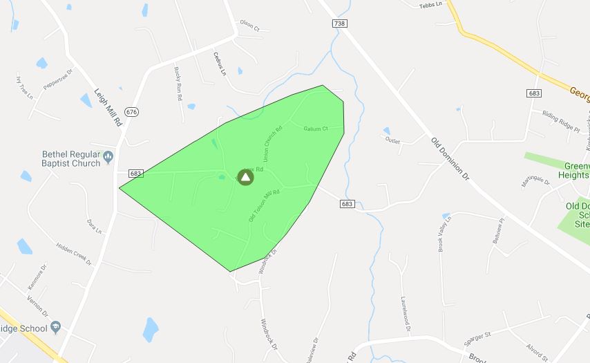
Updated at 2:00 p.m. — The power outages above Wolf Trap and east of Langley Fork Park are now resolved. A new power outage popped up by Great Falls Street and Swinks Mill Road affecting 26 people. Power is expected to be restored between 4-9 p.m. today, according to Dominion.
Earlier: After a morning of violent rain and flooding, around 150 people are left without electricity in the McLean area.
Over by Langley Fork Park, 31 customers are without power because of the storm. Dominion Energy expects power to be restored between 1-6 p.m. today (July 8).
West of Pimmit Park, there are still around 48 people without power. The Dominion Energy map said the outage was caused by a “broken pole.” Crews arrived around 11 a.m. to begin work and people can expect their power to be back between 3-8 p.m.
North of Wolf Trap and just south of Old Dominion Drive, 78 customers don’t have power. The cause is to be determined by the investigation. Dominion expects power to be restored there between 2-7 p.m.
Several other outages affecting nine or fewer people are scattered throughout McLean and Falls Church.
Earlier today, media relations for Dominion Energy said that around 12:30 p.m. the site of a larger power outage was inaccessible to crews because of road washout. That outage was cleared up before 1 p.m.
Anyone without power can report new outages to Dominion Energy at 866-366-4357 or on their website.
Maps via Dominion Energy
")
A Severe Thunderstorm Warning is in effect for McLean.
The watch is in effect until 5:15 p.m. today (Tuesday) and covers northeastern Fairfax County.
The National Weather Service issued the alert around 4:38 p.m.
More from NWS:
At 438 PM EDT, a severe thunderstorm was located near Lowes Island, moving southeast at 25 mph.
HAZARD…60 mph wind gusts.
SOURCE…Radar indicated.
IMPACT…Damaging winds will cause some trees and large branches to fall. This could injure those outdoors, as well as damage homes and vehicles. Roadways may become blocked by downed trees. Localized power outages are possible. Unsecured light objects may become projectiles.
Severe Thunderstorm Warning including Rockville MD, Bethesda MD, McLean VA until 5:15 PM EDT pic.twitter.com/N5xOrAcWh4
— NWS Baltimore-Washington (@NWS_BaltWash) July 2, 2019
")
A Severe Thunderstorm Watch is in effect for Fairfax County.
The watch is in effect until 11 p.m. today (Monday) and also covers several surrounding localities across Northern Virginia.
The National Weather Service issued the alert around 4:05 p.m.
NWS trimmed back its Flash Flood Watch earlier this afternoon, so it no longer includes Fairfax County.
A severe thunderstorm watch has been issued for parts of DE, DC, MD, NJ, PA, VA until 11 PM EDT pic.twitter.com/VN2Fyzlgel
— NWS Baltimore-Washington (@NWS_BaltWash) June 17, 2019
Updated at 2:45 p.m. — NWS canceled the Flash Flood Watch for Fairfax County.
Earlier: Get ready for heavy rain this afternoon and evening.
Fairfax County and surrounding areas are under a Flash Flood Watch starting at 2 p.m. today (Monday).
More from the National Weather Service:
* From 2 PM EDT this afternoon through this evening
* Numerous to widespread showers and thunderstorms are expected this afternoon and this evening in a very warm and humid environment. There is potential for showers to move repeatedly over the same areas and to produce intense rainfall rates in a short period of time that may lead to flash flooding. The greatest risk of flash flooding is across northern and central Maryland.
NWS wants people to monitor the forecast and stay alert to any possible Flash Flood Warnings that may pop up.
The Flash Flood Watch has been trimmed back and now only includes much of northern/north-central MD. Numerous thunderstorms still expected this afternoon, some of which could produce damaging winds. Most likely time period is between 2-8pm. #DCwx #MDwx #VAwx #WVwx pic.twitter.com/NNcL63kHTK
— NWS Baltimore-Washington (@NWS_BaltWash) June 17, 2019
A Severe Thunderstorm Warning is in effect for Fairfax County.
The warning is in effect until 5:30 p.m. today (Thursday) and also covers several surrounding localities across Northern Virginia.
More from the National Weather Service:
At 447 PM EDT, a severe thunderstorm was located over Linton Hall, or 10 miles east of Warrenton, moving northeast at 35 mph.
HAZARD…60 mph wind gusts.
SOURCE…Radar indicated.
IMPACT…Damaging winds will cause some trees and large branches to fall. This could injure those outdoors, as well as damage homes and vehicles. Roadways may become blocked by downed trees. Localized power outages are possible. Unsecured light objects may become projectiles.
NWS recommends that people “move to an interior room on the lowest floor of a building.”
Severe Thunderstorm Warning including Centreville VA, Reston VA, Burke VA until 5:30 PM EDT pic.twitter.com/OYAIqMdN9F
— NWS Baltimore-Washington (@NWS_BaltWash) June 13, 2019
Updated at 2:50 p.m. — NWS has a Severe Thunderstorm Warning in effect for Fairfax County until 3:15 p.m.
More from NWS:
…A SEVERE THUNDERSTORM WARNING REMAINS IN EFFECT UNTIL 315 PM EDT FOR SOUTHEASTERN LOUDOUN…FAIRFAX…NORTH CENTRAL FAUQUIER…AND NORTHWESTERN PRINCE WILLIAM COUNTIES…THE CITY OF FAIRFAX…THE CITY OF MANASSAS PARK AND THE NORTHEASTERN CITY OF ANASSAS…
At 244 PM EDT, a severe thunderstorm was located near Haymarket, or near South Riding, moving east at 40 mph.
HAZARD…60 mph wind gusts and quarter size hail.
SOURCE…Radar indicated.
IMPACT…Damaging winds will cause some trees and large branches to fall. This could injure those outdoors, as well as damage homes and vehicles. Roadways may become blocked by downed trees. Localized power outages are possible. Unsecured light objects may become projectiles.
Earlier: A Severe Thunderstorm Watch is in effect for Fairfax County.
The watch is in effect until 9 p.m. today (Thursday) and also covers several surrounding localities across Northern Virginia, D.C. and Maryland.
NWS tweeted out the watch at 1:58 p.m., saying that a tornado is possible, along with isolated, ping-pong sized hail and scattered winds up to 65 miles per hour.
MT @NWS_BaltWash: Severe Thunderstorm Warning including Centreville VA, Reston VA, Burke VA until 3:15 PM EDT pic.twitter.com/FwqBfQf3MH
— Fairfax County Government 🇺🇸 (@fairfaxcounty) May 30, 2019
2:13 pm: Severe thunderstorm watch is up for the area until 9 pm. Storms gathering strength west, moving into and through western suburbs in the hour or two ahead. https://t.co/veX4ig5glw pic.twitter.com/VT0zC0DDDF
— Capital Weather Gang (@capitalweather) May 30, 2019
Severe Thunderstorm Watch until 9pm for the majority of the DC Metro. Damaging winds are most likely in storms this afternoon and evening, isolated hail is possible along with an isolated tornado. pic.twitter.com/Ki28tgmOYR
— Alex Liggitt (@AlexLiggittWX) May 30, 2019
File photo
A Severe Thunderstorm Warning is in effect for Fairfax County.
The warning is in effect until 4:30 p.m. today (Thursday) and also covers several surrounding localities across Northern Virginia, D.C. and Maryland.
More from the National Weather Service:
At 337 PM EDT, severe thunderstorms were located along a line extending from Mclean to Fairfax, moving east at 20 mph.
HAZARD…60 mph wind gusts.
SOURCE…Radar indicated.
IMPACT…Damaging winds will cause some trees and large branches to fall. This could injure those outdoors, as well as damage homes and vehicles. Roadways may become blocked by downed trees. Localized power outages are possible. Unsecured light objects may become projectiles.
NWS recommends that people “move to an interior room on the lowest floor of a building.”
⚠️⚠️The @NWS_BaltWash has issued a Severe Thunderstorm Warning for @fairfaxcounty For more info https://t.co/EJXeeErbYL ⚠️⚠️
— Fairfax County Fire/Rescue (@ffxfirerescue) May 2, 2019
Severe Thunderstorm Warning including Washington DC, Arlington VA, Alexandria VA until 4:30 PM EDT pic.twitter.com/kSkTGwfRmA
— NWS Baltimore-Washington (@NWS_BaltWash) May 2, 2019
File photo
(Updated at 2:30 p.m.) A Tornado Watch and Severe Thunderstorm Warning are in effect for Fairfax County.
The watch is in effect until 9 p.m. today (Friday). Storms with heavy rain and strong winds are also expected this evening. Several surrounding localities across Northern Virginia, D.C. and Maryland are also covered by the alert.
The Severe Thunderstorm Warning is in effect until 3 p.m. today and covers parts of Northern Virginia and Maryland.
More from the National Weather Service on the Severe Thunderstorm Warning:
…A SEVERE THUNDERSTORM WARNING REMAINS IN EFFECT UNTIL 300 PM EDT FOR MONTGOMERY…SOUTHEASTERN LOUDOUN AND NORTHERN FAIRFAX COUNTIES AND THE NORTHWESTERN CITY OF FAIRFAX…
AT 232 PM EDT, SEVERE THUNDERSTORMS WERE LOCATED ALONG A LINE EXTENDING FROM ASHBURN TO DULLES INTERNATIONAL AIRPORT, MOVING EAST AT 50 MPH.
HAZARD…60 MPH WIND GUSTS.
SOURCE…RADAR INDICATED. DULLES AIRPORT GUSTED TO 53 MPH.
IMPACT…DAMAGING WINDS WILL CAUSE SOME TREES AND LARGE BRANCHES TO FALL. THIS COULD INJURE THOSE OUTDOORS, AS WELL AS DAMAGE HOMES AND VEHICLES. ROADWAYS MAY BECOME BLOCKED BY DOWNED TREES. LOCALIZED POWER OUTAGES ARE POSSIBLE. UNSECURED LIGHT OBJECTS MAY BECOME PROJECTILES.
LOCATIONS IMPACTED INCLUDE… GERMANTOWN, CENTREVILLE, ROCKVILLE, BETHESDA, GAITHERSBURG, RESTON, LEESBURG, OLNEY, SOUTH RIDING, HERNDON, FAIRFAX, VIENNA, DAMASCUS, BROADLANDS, LANSDOWNE, LOWES ISLAND, BRAMBLETON, PIMMIT HILLS, POOLESVILLE AND MCLEAN.
A tornado watch has been issued for parts of DE, DC, MD, NJ, PA, VA until 9 PM EDT pic.twitter.com/7rMIgDS2AQ
— NWS Baltimore-Washington (@NWS_BaltWash) April 26, 2019
11:45 AM FRI – Showers & t-storms will progress east across the region, with some storms becoming strong to locally severe with damaging winds and an isolated tornado possible. Most likely timing: 12-2 PM west of Blue Ridge, 2-4 PM metro areas, 4-6 PM southern MD & near the bay.
— NWS Baltimore-Washington (@NWS_BaltWash) April 26, 2019
Severe Thunderstorm Warning including Germantown MD, Silver Spring MD, Centreville VA until 3:00 PM EDT pic.twitter.com/7GWxweSheR
— NWS Baltimore-Washington (@NWS_BaltWash) April 26, 2019

Update 1 p.m. — The National Weather Service has issued a Tornado Watch for the region until midnight with Flash Flood Watch remaining in effect.
Hope you brought a rain jacket, Tysons, because the region is expected to get soaked this afternoon (Friday) through tomorrow morning.
A Flash Flood Watch has been issued for the region, including Fairfax County, with 1.5-2 inches of rain expected but even more possible. More from the National Weather Service:
…FLASH FLOOD WATCH REMAINS IN EFFECT FROM NOON EDT TODAY THROUGH LATE TONIGHT… SHOWERS AND THUNDERSTORMS WITH HEAVY RAIN ARE EXPECTED TO OVERSPREAD THE REGION BY THIS AFTERNOON AND CONTINUE THROUGH THIS EVENING BEFORE DEPARTING LATE TONIGHT. REPETITIVE STORMS AND MULTIPLE ROUNDS OF HEAVY RAIN MAY RESULT IN RAINFALL AMOUNTS WHICH COULD EXCEED 3 INCHES LOCALLY. FLASH FLOODING IS POSSIBLE, PARTICULARLY IN URBAN AREAS AND IN AREAS OF STEEP TERRAIN. PRECAUTIONARY/PREPAREDNESS ACTIONS… A FLASH FLOOD WATCH MEANS THAT CONDITIONS MAY DEVELOP THAT LEAD TO FLASH FLOODING. FLASH FLOODING IS A VERY DANGEROUS SITUATION. YOU SHOULD MONITOR LATER FORECASTS AND BE PREPARED TO TAKE ACTION SHOULD FLASH FLOOD WARNINGS BE ISSUED. &&
The flooding potential is of particular concern to parts of the Tysons, McLean and Vienna area that are flood prone.
The potential for severe weather has also prompted some airlines to waive change fees for travel Friday. Forecasters say damaging storms are possible later today.
Severe thunderstorms with considerable potential for producing DAMAGING WIND gusts and a few tornadoes are LIKELY across much of the southern through mid Atlantic Coast region, particularly across the Carolinas into southern/central Virginia, THIS AFTERNOON and EVENING. @NWSSPC pic.twitter.com/3GItR4Z0Rg
— National Weather Service (@NWS) April 19, 2019
With storms in the forecast, several airlines, including @united & @Delta, are offering change fee waivers for travel today. Contact the airline directly if travel plans are impacted by weather & be sure to double check the status of your flight before coming to the airport. pic.twitter.com/HaFHwIWP50
— Reagan Airport (@Reagan_Airport) April 19, 2019