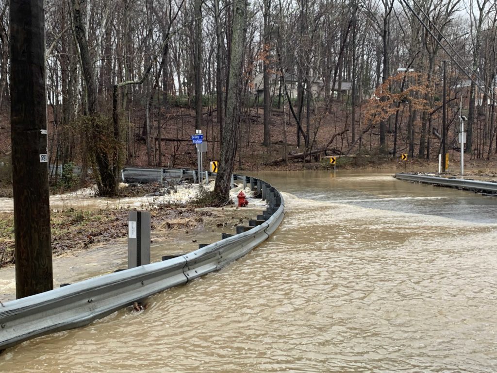
If last week’s surprise rainstorm was any indication, the Tysons area is in for a wet spring and some extensive flooding.
Last year was the rainiest on record for the region, which has not only taken a toll on local roads but also hit the area with flooding that has frequently closed streets.
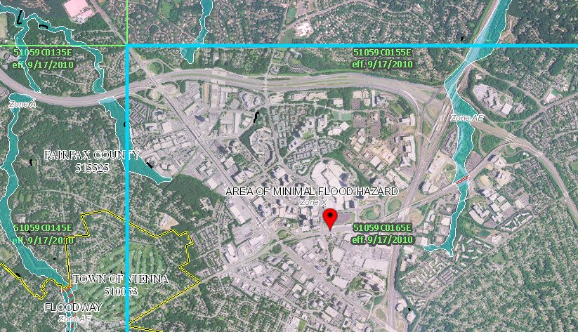
A map put together by the Federal Emergency Management Agency showed the regional flood hazard areas, which unsurprisingly mostly follow local creeks.
Most of the flood hazards around Tysons itself are on the periphery. Old Courthouse Spring Branch just west of the Spring Hill Metro station is vulnerable to flooding, as is Scott’s Run, which runs through Tysons East.
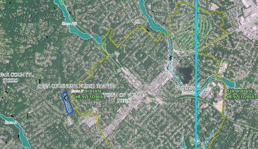
In Vienna, the main flooding hazard is Wolftrap Creek, which runs along the Tysons-Vienna border. There are several low roads through the area, like Old Courthouse Road, which are subject to being washed out during flooding. The area north of Vienna along Piney Branch is also susceptible to flooding.
A 2016 study found that the sewer system along Maple Avenue in Vienna would be unable to handle significant rainfall, but sewer renovations remain unfunded.
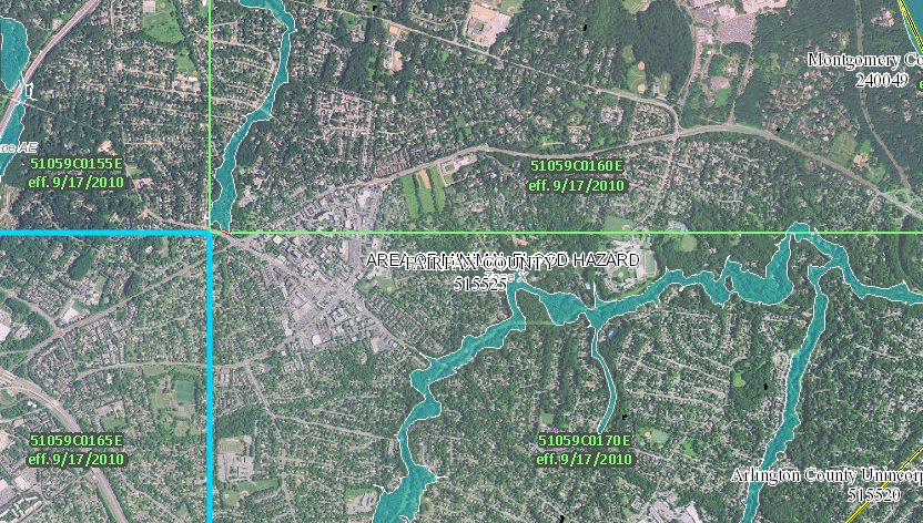
In McLean, Dead Run Stream and Pimmit Run are both flood hazard areas, though Dead Run Stream has recently completed a series of revitalization projects whose aim was partially reducing the amount of flooding in the park.
Recent Stories

Joon has expanded its offerings in Tysons with the addition of a bar and patio. Named after a poetic Farsi term for “wine,” May Bar began serving customers inside the…

Owners of six Woofie’s franchises in Northern Virginia are hosting a “Paws in the Park” pet adoption event tomorrow (Saturday) at Wolf Trap National Park. Participating Woofie’s include Reston/Herndon, Ashburn-Leesburg,…

A Fairfax Connector bus to Tysons (staff photo by James Jarvis) The Fairfax County Department of Transportation (FCDOT) has the green light to apply for a federal grant to replace…

The country band Delta Spur performs on the Plaza at Tysons Corner Center for the mall’s 2023 summer concert series (courtesy Tysons Corner Center) Fresh produce, good dogs and live…