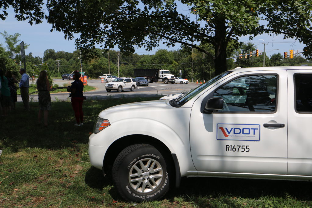
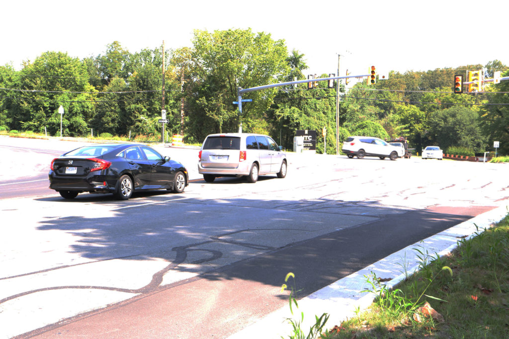
A long-awaited project to lessen congestion at an intersection near the American Legion Bridge in McLean is nearing completion.
The Virginia Department of Transportation expanded the intersection by 550 feet to include a left turn and right turn lane, as well as an option for traffic to go straight into the nearby neighborhood. The renovations also include an area where law enforcement can safely pull over traffic.
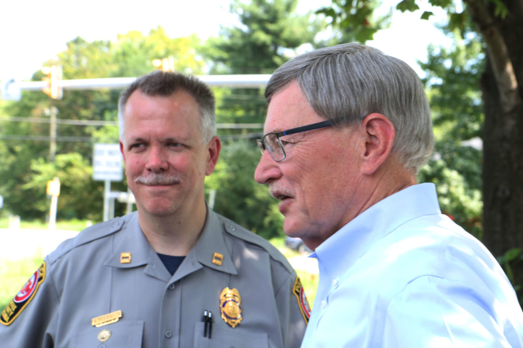
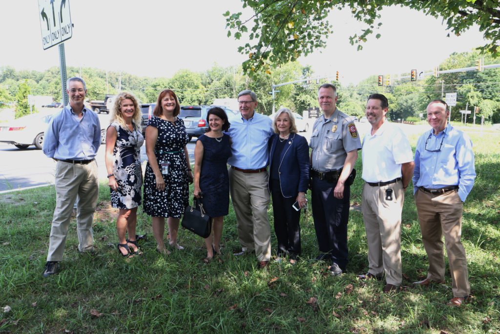
Crews worked on the three-month-long project at the intersection of Georgetown Pike and Balls Hill Road over the summer. Politicians gathered Thursday morning (Aug. 22) to survey the scene and celebrate the project.
Allison Richter, a VDOT liaison for Fairfax County, attended the event and said that people in the nearby neighborhood struggled to get home when others were trying to turn onto American Legion Bridge or onto the freeway. The addition of turn lanes is expected to ease traffic around rush hour, she said.
Richter said that this was part of a $500,000 project to improve traffic flow in the area, which should be completed in the next couple days. She also said that roughly $250,000 of the funds came from Fairfax County while the remaining $250,000 came from an operations safety budget.
“This is one of the rare occasions we meet at this intersection on a happy note,” Dranesville District Supervisor John Foust told the gathering. “This has been a challenge to deal with the intersection and try to meditate the impact on the surrounding neighborhoods from the American Legion Bridge and back up on the ramp.”
Road crews had to redirect some attention from the work on Balls Hill Road to roads impacted by severe flooding in early July, Foust said.
Crews are still working to repair Kirby Road, which is still closed due to flooding damage, he said, adding that the floods completely rerouted the river, which now flows underneath the road.
The city needs to get permits from the Army Corps of Engineers to fix the damage.
“There is only so much we can expedite,” Foust said, adding that he believes that the residents have been patient with the process.
As for the road crews, “I don’t know if I’ve ever seen VDOT so focused,” Foust said.
Just in time for #backtoschooll! VDOT crews completed improvements incl a dedicated left-turn lane to help ease congestion at Balls Hill Rd & Georgetown Pike in McLean. Take a look! Thanks to our partners @fairfaxcounty @FairfaxCountyPD @johnfoustva @kmurphyva @BarbaraFavola! pic.twitter.com/es74W6OVfJ
— VDOT Northern VA (@VaDOTNOVA) August 22, 2019
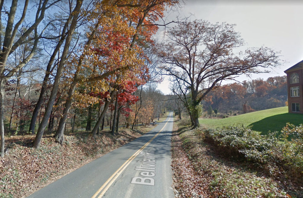
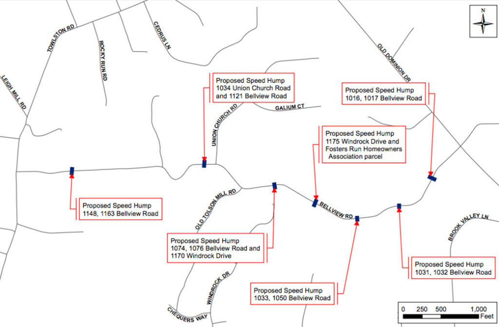
New speed humps are coming to the windy Bellview Road in McLean next month.
Known for its cut-through traffic use, the two-lane road runs from just north of Wolf Trap to Georgetown Pike, bisecting Old Dominion Drive along the way.
The upcoming traffic calming measures will add seven speed humps along the road.
“The speed humps on Bellview will be installed in coordination with planned repaving, which is expected to take place the third or fourth week of September,” Jennifer McCord, a spokeswoman for the Virginia Department of Transportation, told Tysons Reporter.
Another McLean road will also undergo traffic calming measures.
In July, the Fairfax County Board of Supervisors approved two speed tables, longer, flat-topped version of speed humps, for Youngblood Street.
Youngblood Street connects a residential area in Chesterbrook Gardens to Westmoreland Street.
“[The Fairfax County Department of Transportation] is finalizing plans for installation, and will then send to the Department of Public Works and Environmental Services,” FCDOT spokesperson Robin Geiger told Tysons Reporter. “The timeline for completion could be fall 2019.”
Image 1 via Google Maps, image 2 via FCDOT, map via Google Maps

The anticipation is almost over for bicyclists and drivers who have been waiting for permanent lane markings along Greensboro Drive by The Boro development.
Jennifer McCord, a spokeswoman for the Virginia Department of Transportation, told Tysons Reporter that the roadwork is being completed by a developer under permit.
“The developer plans to install the pavement markings for the bicycle lane on Greensboro Drive between Westpark Drive and Solutions Drive on Thursday, Aug. 8, 2019, weather permitting,” McCord said. “The other markings should be in place by Aug. 21.”
“I’m not sure how a bike commuter, pedestrian, scooter (or an [Single Occupant Vehicle] even) is supposed to safely navigate this area,” a self-identified cyclist tweeted Aug. 1.
Please please help. Thx. I'm not sure how a bike commuter, pedestrian, scooter (or an SOV even) is supposed to safely navigate this area. pic.twitter.com/mEGhKrSO6m
— Chris French (@chrislfrench) August 1, 2019
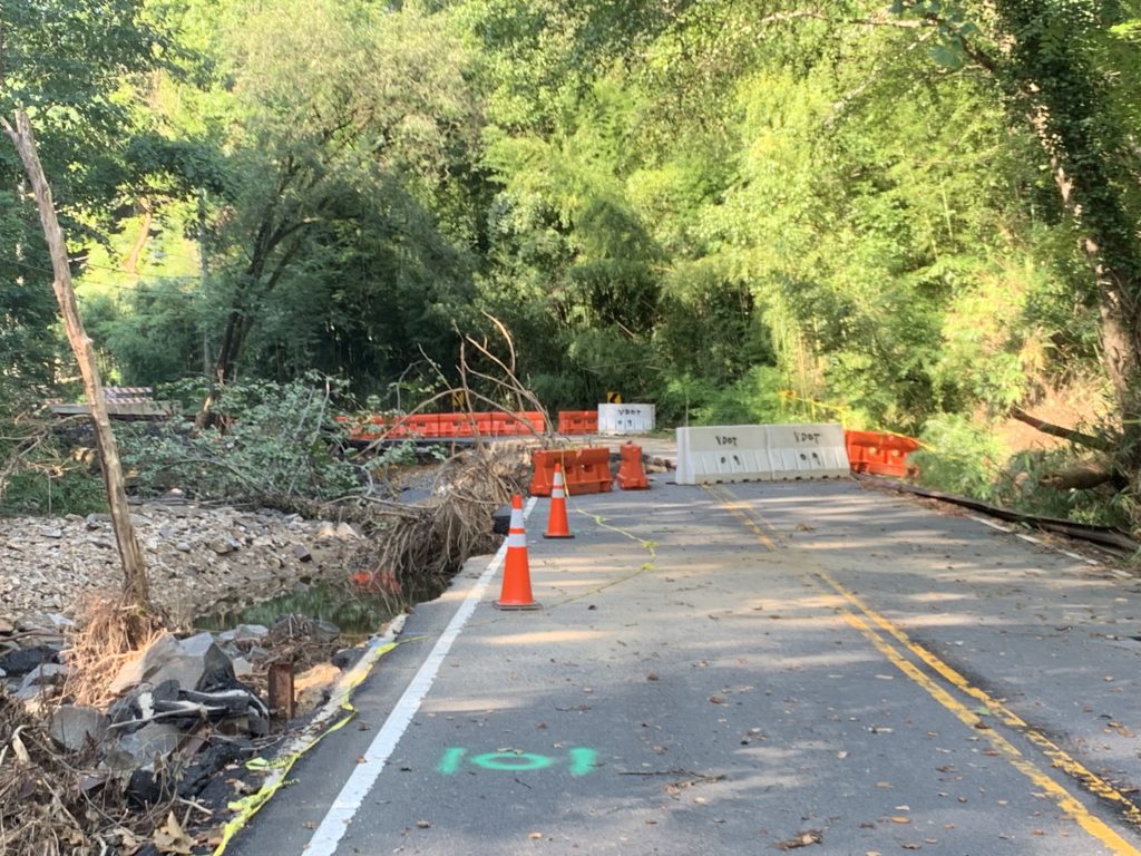
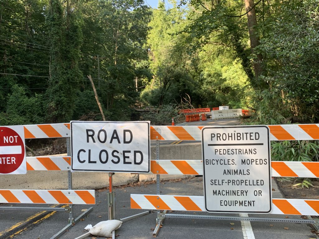
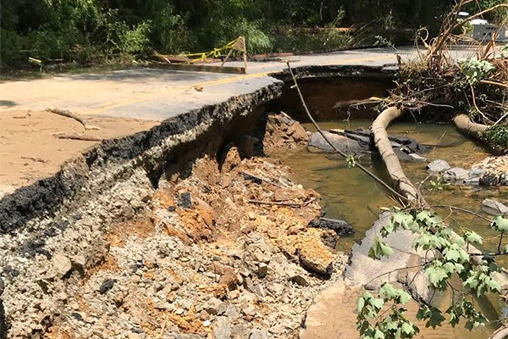
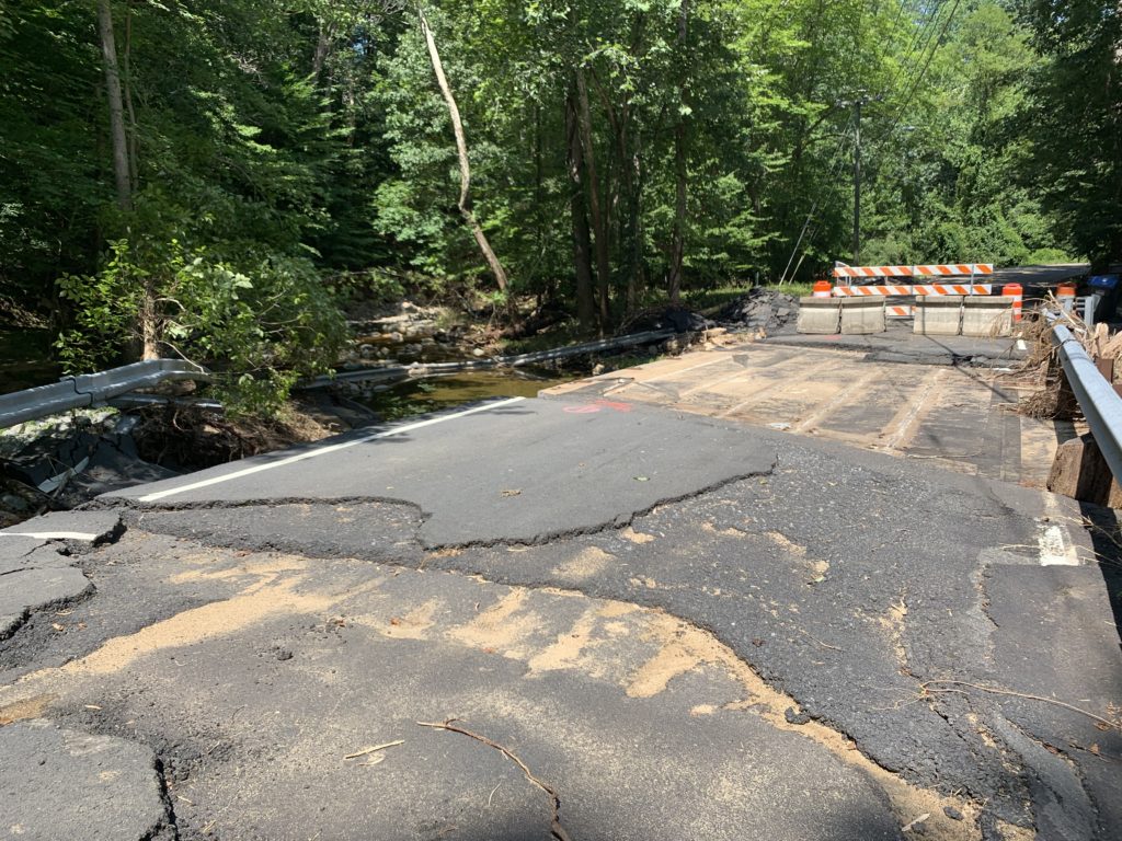
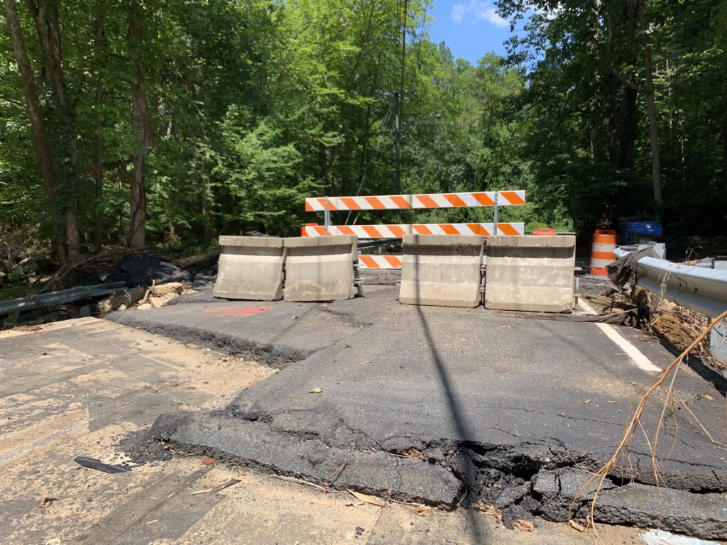
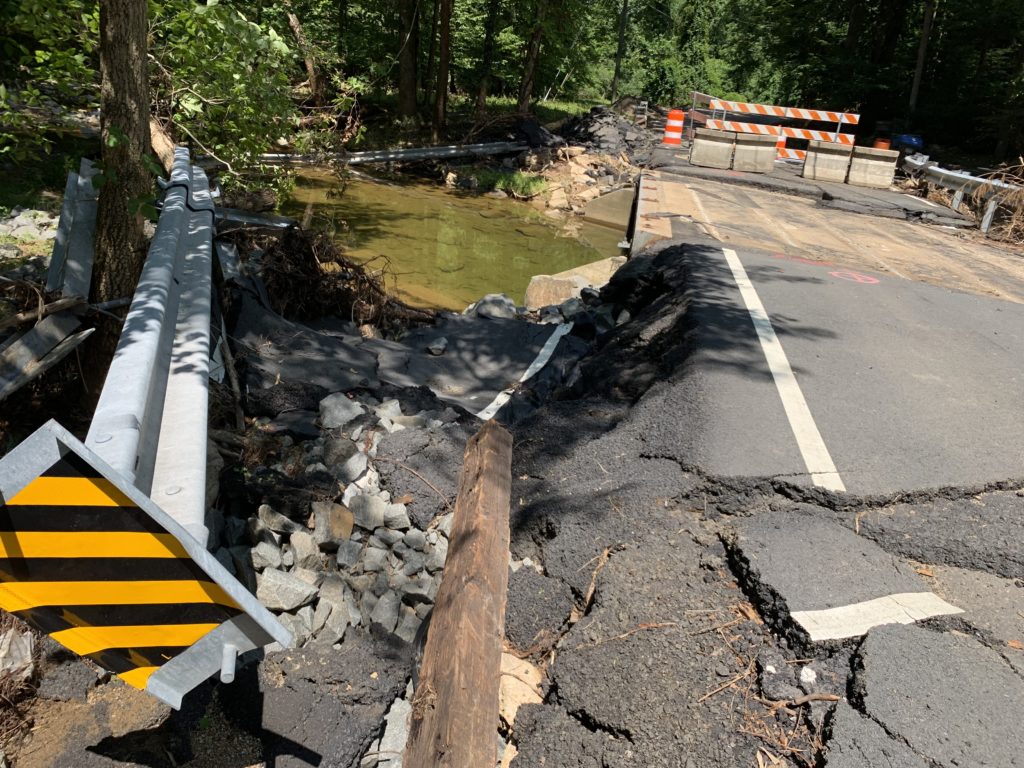
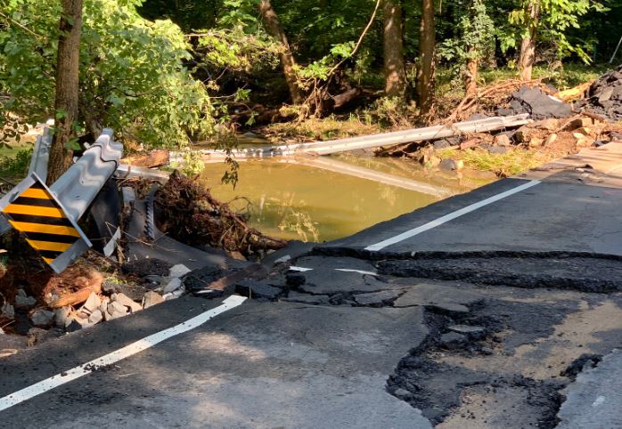
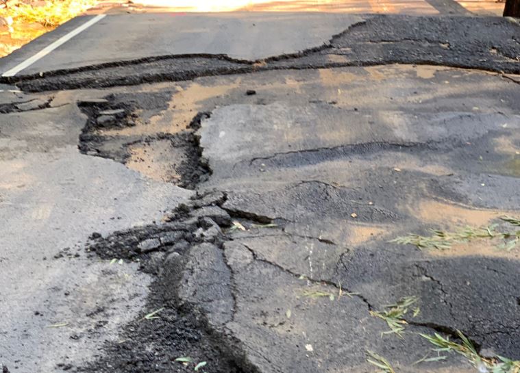
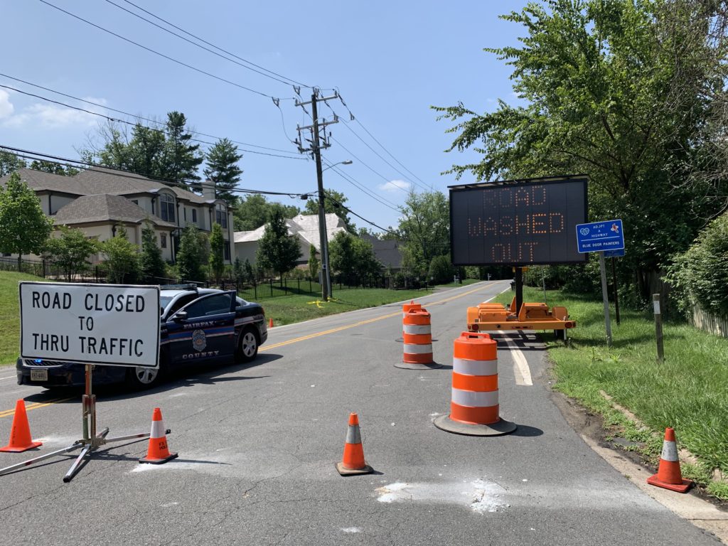
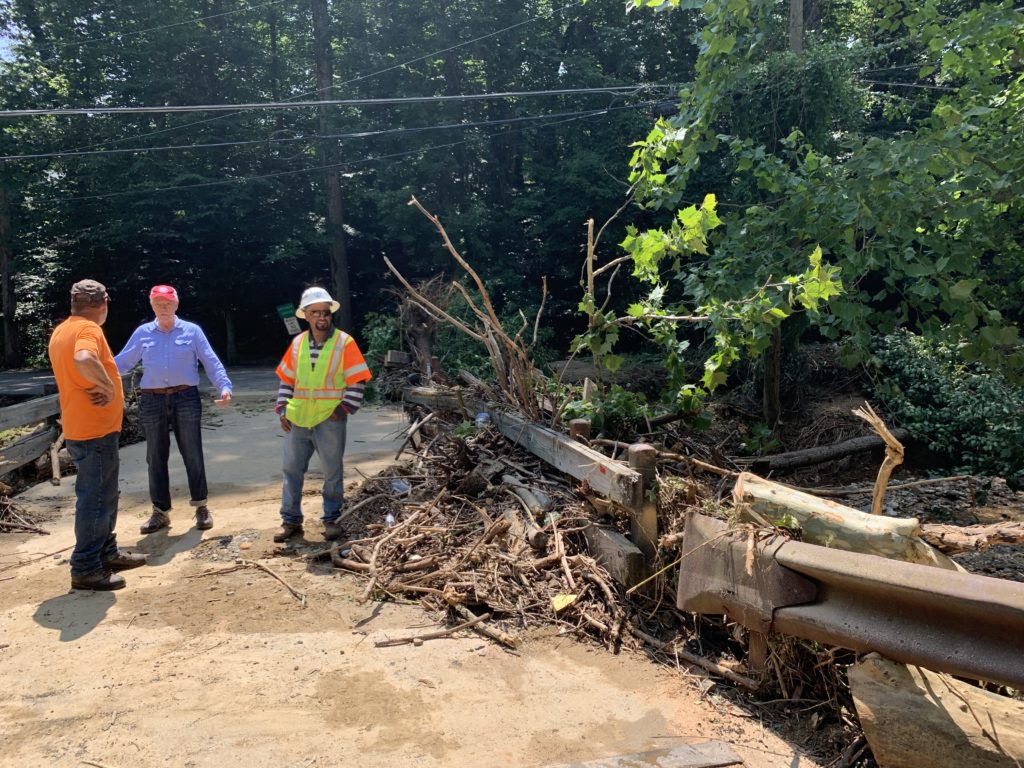
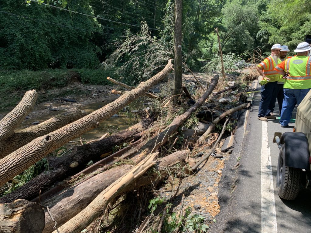
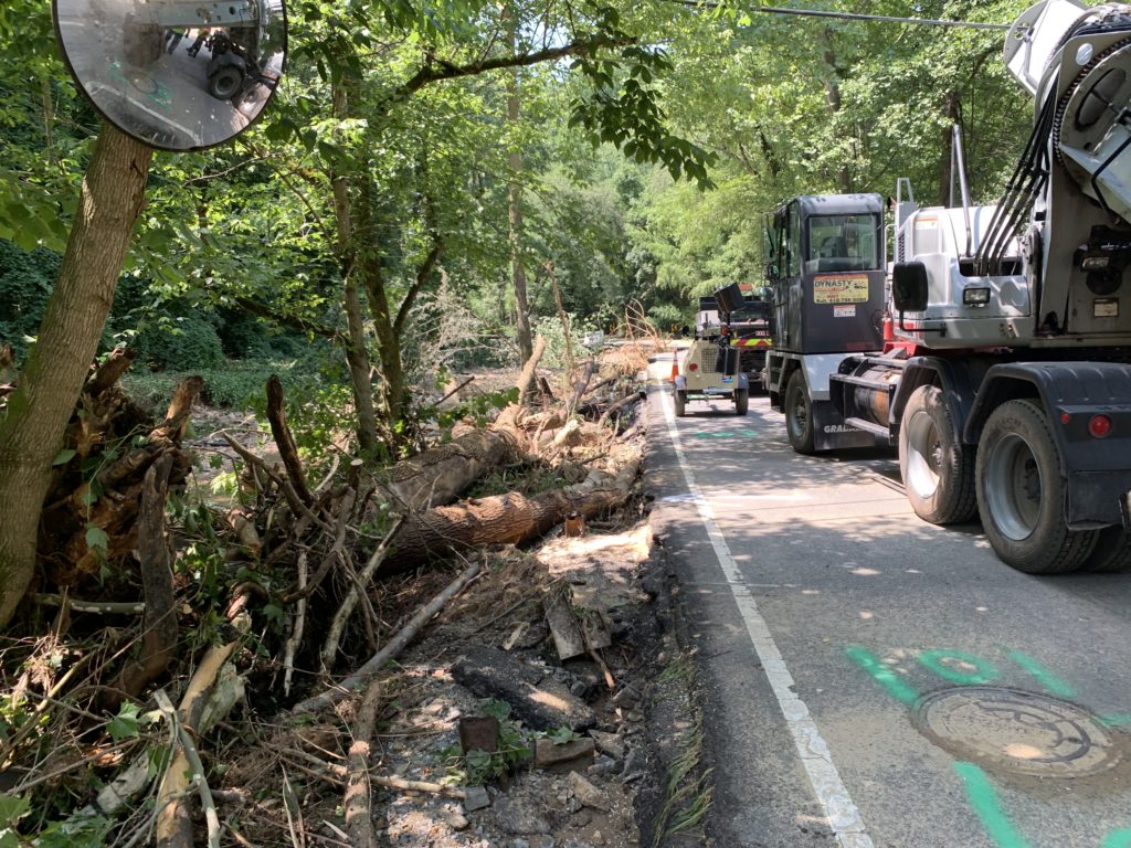
Much of the roads affected by the flash floods two weeks ago have been fixed, but two routes through McLean remain out of commission and will require long term repairs.
Kirby Road and Swinks Mill Road at the eastern and western edges of McLean respectively are both blocked off at roughly the halfway point where the roads were severely damaged by floodwaters.
Replacing the damaged bridges will take several months, according to Virginia Department of Transportation (VDOT) spokesperson Ellen Kamilakis.
A part of Kirby Road has been broken off with much of the supporting infrastructure underneath completely swept away. According to a press release from VDOT:
-
A segment of road just south of Claiborne Drive was washed away. The remaining asphalt in that location has been undermined.
-
Asphalt on the approaches to the deck of the VDOT bridge over Pimmit Run was damaged, but temporarily repaired the same day. The bridge also has damage to the guardrails and abutments (the “legs” that support the bridge deck) and retaining wall.
-
Pimmit Run will need to be realigned to its original location.
-
The sanitary sewer line and underground utilities were affected.
-
Damage to VDOT infrastructure is not preventing access to any homes.
-
Note: A privately owned and maintained bridge across from Claiborne Drive was severely damaged and homeowners are evaluating repair options.
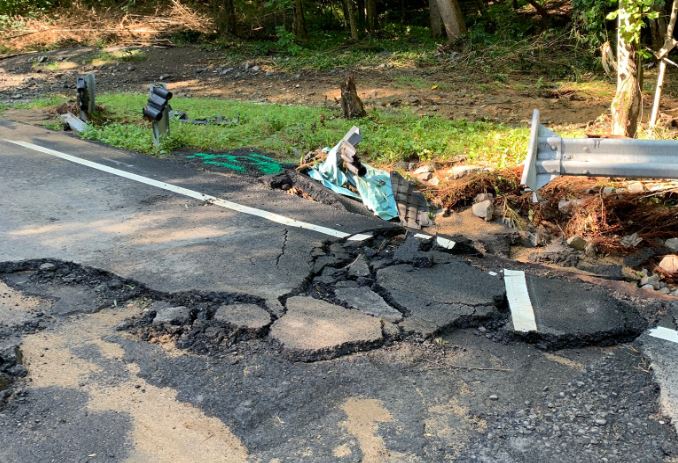
Meanwhile, at Swinks Mill Road the asphalt on the bridge was completely destroyed, with the guard rail and large chunks of the road visible warped and scattered down the creek bed. According to the VDOT press release:
-
Several hundred feet of asphalt approaching the bridge on both sides was damaged.
-
Asphalt on the bridge deck was destroyed. Also, the bridge has sustained damage to the guardrails, abutments, and retaining wall.
-
Bridge scour (removal of sand and gravel from around the abutments) was observed.
-
Debris was observed in Scotts Run.
-
Damage to VDOT infrastructure is not preventing access to any homes.
Currently, VDOT said surveys are underway for the planned realignment of both streets. Preliminary design work has started for both bridges and road repairs, according to the press release.
Removal of debris is expected to continue alongside more extensive survey work at both locations. Once bridge designs are finalized, VDOT said the bridge and road repair plans will be put out for construction bids.

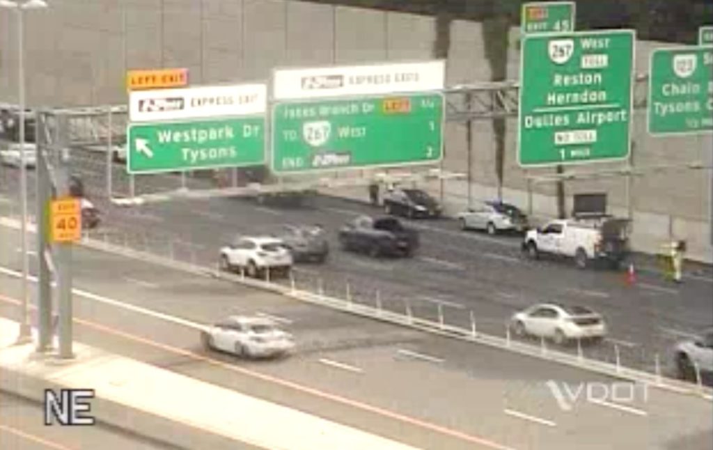
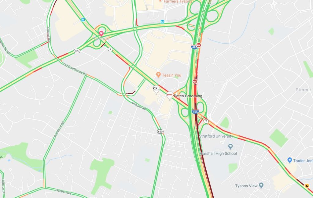
As work continues on the Jones Branch Connector, Scotts Crossing Road, a road between Jones Branch Drive and the off-ramps for I-495 Express Lanes, will close overnight on Thursday (July 25).
The Virginia Department of Transportation said that Scotts Crossing Road will be closed from 10 p.m. on Thursday to 4 a.m. on Friday (July 26). Drivers heading north or south will have several detour options.
More from VDOT:
The ramps from the northbound and southbound I-495 Express Lanes to Scotts Crossing Road will remain open and traffic will still be able to access Route 123 via eastbound Scotts Crossing Road.
Route 123 traffic will still be able to access the northbound I-495 Express Lanes via westbound Scotts Crossing Road.
Currently, the Jones Branch Connector is undergoing construction for a $60 million project that will add two travel lanes and on-street bike lanes in each direction — the two lanes are set to open by the end of the year. Sidewalks are slated to open later this summer.
VDOT expects the project to be completed in spring 2020.
Map via Google Maps
Another McLean road requires lengthy repairs after suffering damage from Monday’s major flash flooding.
In addition to Kirby Road’s closure due to severe storm damage, Swinks Mill Road by Scott’s Run is also closed, Jennifer McCord, a spokeswoman for the Virginia Department of Transportation, told Tysons Reporter.
“We are making plans for permanent repairs at all locations that will likely take at least several weeks,” McCord said.
The two roads are the only remaining ones closed in Fairfax County for long-term repairs, McCord said.
“Crews worked around the clock on cleanup this week, clearing debris, assessing damages and making temporary repairs to reopen roads, and continued to respond to heavy rains received yesterday evening,” McCord said.
Flood Update: All roads have reopened except Swinks Mill, Kirby & Princedale (long-term closures). Reopened roads may be a little rough, so pls use caution. Crews continue to assess damage & work on repairs. Report damage at https://t.co/12wxgee8pi or 800-FOR-ROAD. Thanks! pic.twitter.com/UBlvuum9NT
— VDOT Northern VA (@VaDOTNOVA) July 12, 2019
Photos courtesy @jase700/Twitter, map via Google Maps
Update on 7/10/19 — Both lanes of Kirby Road from Dolley Madison Blvd. to Claiborne Drive are open, but traffic barriers have been set up past that, according to information from the Fairfax County Office of Emergency Management and forwarded by Dranesville District Supervisor John Foust.
Earlier: Severe weather damage will keep Kirby Road closed in McLean to through-traffic for the foreseeable future.
The road runs from Dolley Madison Blvd near the George Washington Memorial Parkway down to Great Falls Street. But flooding at Pimmit Run from storms yesterday means that while residents in the area are able to access their homes, the route no longer connects Dolley Madison Blvd to Old Dominion Drive.
Kirby Update: Crews cleared more debris for access. But as you can see, the road will be closed for some time. We added more layers of barricades 🚧 to keep people from going around the barriers to walk/bike on the damaged road. Huge thanks to @FairfaxCountyPD for their support! pic.twitter.com/xdHFY8KZuL
— VDOT Northern VA (@VaDOTNOVA) July 9, 2019
“We have no specific timeline, but it will be weeks,” Ellen Kamilakis, a spokesperson for the Virginia Department of Transportation, told Tysons Reporter. “The water tore right through the road [and] exposed the area underneath all the way.”
RT @FairfaxCountyPD: The 1300 block of Kirby Road in McLean suffered extensive damage due to today’s storm. It will be closed for significant time until the damage can be assessed and repaired. #FCPD #FairfaxCounty #TurnAroundDontDrown pic.twitter.com/VeV7ILqmDZ
— Fairfax County Fire/Rescue (@ffxfirerescue) July 8, 2019
Part of the upper asphalt is visible carved away by the storm, but Kamilakis said the damage underneath is so extensive that the road would not be able to support the weight of a car. Kamilakis said the road will require complete reconstruction — and a review of whether the road needs stormwater upgrades.
Earlier today (Tuesday) traffic on the road was stopped near Dolley Madison Blvd as the crew worked to finish clearing a debris-cluttered bridge, but Kamilakis said the closure will be tightened up to just the area immediately surrounding the broken section of the road.
Kamilakis said the cleaning crews had been working overnight to clear away the debris, and the VDOT Twitter noted that the efforts were rewarded by one local man who brought water to the workers.
KINDNESS MATTERS: Crews have been working on Kirby since last PM. This nice resident brought our crews water. This def makes up for a couple residents who were (unfortunately) not so kind about us not letting them walk across a washed out road. PLEASE don’t cross our barriers! pic.twitter.com/Q1iTPDqoIQ
— VDOT Northern VA (@VaDOTNOVA) July 9, 2019
Those trying to get from northern McLean to areas near Arlington will either have to go thrown “downtown” McLean or go further east to Glebe Road.
A significant section of Kirby Road between Chesterbrook Road and 123 is closed. Drivers should avoid Kirby in this area if possible.
VDOT crews will be working to make repairs to the road overnight and emergency personnel are on-site to escort residents to their homes. #McLean
— John Foust (@johnfoustva) July 8, 2019
")
(Updated at 1 p.m.) Drivers can expect delays along Leesburg Pike (Route 7) from a multi-vehicle crash near Lewinsville Road.
The west left lane and center lane are closed, according to the Virginia Department of Transportation.
Tysons Reporter noted that traffic is down to one lane westbound on Leesburg Pike as police arrest someone for a traffic stop unrelated to the crash.
Accident: WB on VA-7 at MM0 in Fairfax Co. 2 WB travel lanes closed.11:44AM
— 511 Northern VA (@511northernva) July 2, 2019
Map via Google Maps
Updated at 11:35 a.m. — All travel lanes on I-495 reopened around 10:30 a.m.
Earlier: A multi-car crash on I-495 is causing substantial delays in Tysons.
Shortly after 9:30 a.m., the north right outside lane and right shoulder closed, according to the Virginia Department of Transportation.
Drivers can expect delays, according to VDOT. As of 9:50 a.m., traffic is crawling along northbound I-495 up to Route 123.
FINAL: Multi-Vehicle Crash with Injury. I-495 NB (Inner Loop) Main Lines before VA-123 (Exit 46). Fairfax County, Virginia. Incident contained to right shoulder and all travel lanes are reopened. Delays remain beginning near VA-620.
— MATOC Alerts (@MATOC) June 25, 2019
Update: Accident: NB on I-495 at MM47 in Fairfax Co. 1 NB travel lane closed.9:32AM
— 511 Northern VA (@511northernva) June 25, 2019
First image via VDOT, second image via Google Maps
")
Updated at 12:50 p.m. 6/24/19 — Leesburg Pike reopened on Saturday (June 22).
As rush hour starts up, all lanes on Leesburg Pike (Route 7) near Pimmit Drive still remain closed following a water main break this morning.
The Fairfax County Police Department took to Twitter shortly after 3 p.m. to advise people to avoid the area.
Drivers can expect delays until 5 p.m. today, according to the Virginia Department of Transportation. Route 28A route for Metrobus, which runs along Leesburg Pike, is currently experiencing delays as well.
Currently, traffic is slow-moving along Leesburg Pike from I-495 to just past I-66.
John Gonzalez, an ABC7 reporter, tweeted right before 7 a.m. that a water main break caused the closure.
View from Route 66 of traffic backed up on Route 7 pic.twitter.com/GYPVzq0SfZ
— Tysons Reporter (@TysonsReporter) June 21, 2019
UPDATE: All lanes of Leesburg Pike (Rt 7) near Pimmit Drive remain closed for emergency road repairs. Delays are expected through the rush hour while crews work to make repairs. Please avoid the area. #FCPD #FairfaxCounty pic.twitter.com/NiFu5mYyMa
— Fairfax County Police (@FairfaxCountyPD) June 21, 2019
https://twitter.com/ABC7TimBarber/status/1142111926245371905
AVOID: Water main break on Leesburg Pike at Patterson rd a mile from 66 in Falls Church. Crews are just starting to dig to try to locate the break. Gushing water has severely damage roadway. All lanes on RT 7 closed. Traffic is trickling by in service lane on each side. @ABC7GMW pic.twitter.com/P1rL8VzmyP
— John Gonzalez (@John7News) June 21, 2019
Map via Google Maps