
The City of Falls Church is looking to implement a pilot program for scooters as a deadline nears for scooter regulation.
Legislation passed during the General Assembly session in January allows localities to regulate scooters and motorized skateboards, however, the localities have until Jan. 1, 2020 to take action to implement any regulations. After that date, the scooter companies can zoom around as they see fit.
Scooters, an increasingly popular alternative transportation option, are already around the area.
The City Council is set to discuss the proposed pilot program, which would allow the city to regulate bicycles and motorized skateboards, scooters and bicycles for hire, at a work session tonight (Tuesday).
The proposed program would allow the motorized vehicles and bicycles for hire to ride on the sidewalks and streets and would limit speeds to 20 miles per hour for bicycles and motorized bicycles and to 10 miles per hour for scooters and skateboards.
Additionally, the city would cap the maximum number of devices to 25 per company, allowing the company to increase the number with extra permit fees. Each company would have to pay a permit fee of $100 per device.
The proposed pilot program is set to go before the City Council for a review on Sept. 23 ahead of a planned adoption in October or November.
The City Council is also scheduled to discuss spot pedestrian improvements tonight.
“The ultimate goal is to provide an adequate and safe walkway system and for the city to ultimately achieve ‘Walk Friendly Community’ designation,” City Manager Wyatt Shields wrote in a memo to the mayor.
City staff chose several projects recommended by the Citizens Advisory Committee on Transportation totaling $100,000 — the amount set aside in the FY 2020 city budget for short-term spot improvements for pedestrian safety.
One project costing $45,000 would install a new sidewalk at S. Oak Street near Seaton Lane to close an 80-foot “missing link” along the busy corridor near TJ Elementary School.
The staff also recommended a $40,000 improvement that would install a new sidewalk at 304 S. Maple Avenue, closing a 60-foot gap in the sidewalk.
Finally, the staff plan to use $15,000 to install handicap-accessible ramps at locations that need them.
Some of the projects identified by the Citizens Advisory Committee on Transportation didn’t fit the city’s budget, like removing utility pole obstacles.
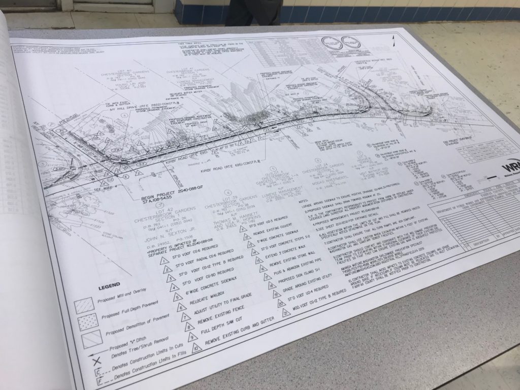
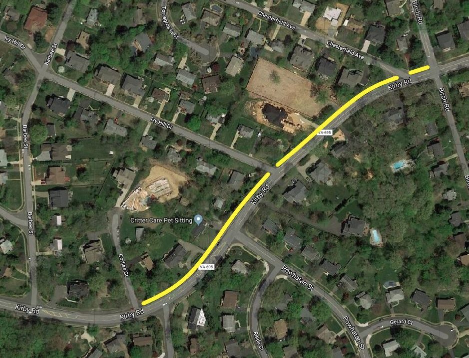
Construction on improvements to Kirby Road south of Chesterbrook Elementary School is slated to start in September.
The Fairfax County Department of Transportation gave residents an update yesterday (Wednesday) on the sidewalks project spanning from Birch Road to Corliss Court along Kirby Road.
Latesa Turner, an FCDOT engineer, gave a presentation to a small group of people at Chesterbrook Elementary School (1753 Kirby Road) last night shortly after 7 p.m.
The project would add the following new elements to Kirby Road:
- a 5-6-foot wide concrete sidewalk and ADA-accessible curb ramps
- concrete curb and gutter
- drainage inlets and pipes
- driveway entrances
- pedestrian crossing and median refuge at Powhatan Street
- re-alignment of Chesterfield Avenue intersection
- water main reconstruction and upgrades
- road pavement and striping
The first phase of the project, which will last between three to four months, will involve closing the westbound lane of Kirby Road to construct the water line relocation, according to the presentation. Drivers can expect traffic maintained in both directions during the lane closure.
Then, the second phase will involve closing the westbound lane of Kirby Road for drainage and utility work, along with work on the curb ramps, driveway entrances, sidewalk and gutter. The second phase is expected to last five to six months, according to the presentation.
The contractor will come out within the next week for clearing and tree removal. Then, construction will start in September. The first phase is slated to be done around December and most of the work will be completed by February. All of the work is slated to be finished by April 2020.
Once finished, Turner said that the Virginia Department of Transportation will maintain the sidewalks.
When asked why it took two years for the project to start construction, Turner said that many steps had to take place after the idea was approved including finalizing the plans, receiving VDOT approval, permitting and bidding for the project after the land acquisition in late 2017.
Despite some grumblings among attendees about waiting for the improvements, many expressed support for the upcoming work.
“I’m really glad you’re doing this,” one attendee told Turner toward the end of the meeting.
Image 4 via Fairfax County
Pedestrians will soon be able to get over I-495 once the Jones Branch Connector’s sidewalk open, connecting North Central to Tysons East.
Currently, the Jones Branch Connector is undergoing construction for a $60 million project that will add two travel lanes and on-street bike lanes in each direction.
“Right now the Jones Branch Connector sidewalk is slated to open mid- to late summer 2019,” Michael Murphy, a spokesperson for the Virginia Department of Transportation, told Tysons Reporter.
Back in December, the Jones Branch Connector partially opened with one lane of traffic in each direction, but “Sidewalk Closed” signs have kept pedestrians away.
“By providing an alternate route across the Beltway and linking the Tysons East and Central areas, the Connector is expected to relieve traffic along Route 123, at the I-495 interchange, and at other congested intersections,” according to VDOT. “The road is expected to carry more than 32,000 vehicles per day by 2040.”
The project is slated to finish in the fall.
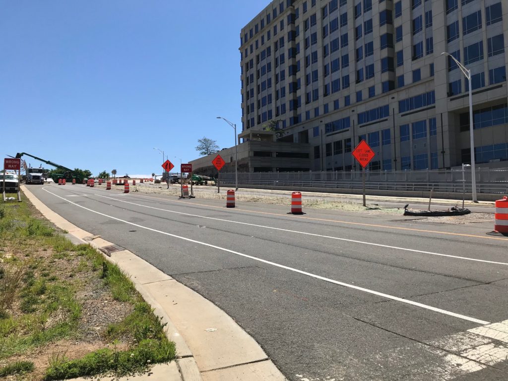
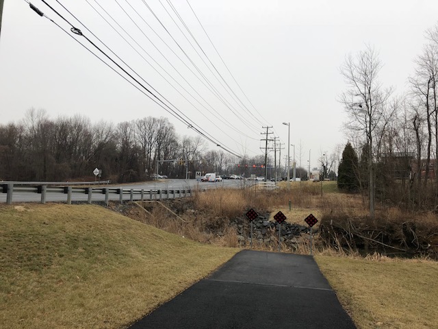
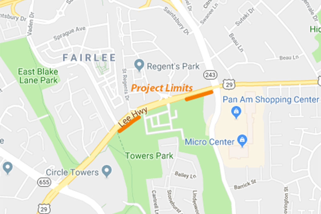
For years, the shared sidewalk on the south side of Lee Highway has ended abruptly with a ditch.
But a planned bike/pedestrian path on the highway just south of the Vienna Metro station could finally bridge that divide and make the sidewalks more walkable.
At a meeting tonight (Tuesday), Virginia Department of Transportation (VDOT) is scheduled to discuss plans to complete missing segments of a shared-use path on the southern side of Lee Highway between Vaden Drive and Nutley Street. The path aims to improve safety and accessibility for bicyclists and pedestrians near the Fairlee neighborhood.
The $1.3 million project is being funded through the Transform I-66 Outside the Beltway project.
Design approval for the project is scheduled for this fall, with construction beginning summer 2021.
The meeting is scheduled for 6:30 at Fairhill Elementary School (3001 Chichester Lane) with a presentation starting at 7 p.m.
Last week, Tysons Reporter examined the importance of sidewalk design as Tysons expands its pedestrian infrastructure network.
But no matter how well-designed a sidewalk might be, what matters most is that it’s in the right place.
There are three guidelines that Tysons can follow to make its pedestrian infrastructure more complete. The first is simply to find where people are already walking. The second is to connect sidewalks to public transit. The third is to provide cut-throughs in large blocks, connecting up the network.
Find the demand
An old architecture-school anecdote mentions a designer who was hired to lay out paths across a new college campus.
For the first months of the year, she left the entire campus unpaved, and students walked across the grass to their classes.
After the first snowfall, she took pictures of the quad from the bell tower, and then laid out the paths wherever she saw footprints in the snow.
In just the same way, dead grass and bootprints in Tysons reveals pedestrian activity. These are called “desire paths.”
They’re useful for transportation planners because they can prove, no speculation needed, that there really is demand for a sidewalk in a particular place. Even Tysons Plaza, connecting the mall to the Metro station, shows desire paths.
Desire paths can easily be paved over by the owner of the land, whether that is Fairfax County, the Virginia Department of Transportation, or a private interest. According to VDOT’s Project Cost Estimating System, a sidewalk costs only $25.15 per linear foot to install in Northern Virginia — it’s hard to think of a more affordable investment in transportation.
You can find desire paths all over Tysons at the ground level, especially near transit stations — which leads us to the next guideline.
Follow the transit
Public transportation and walkability have a symbiotic relationship. Unlike cars, buses and trains rarely drop passengers off right at their destination, meaning that they generally have to walk the final fraction of a mile. But in Tysons, that final stroll can be made circuitous, dangerous or uncomfortable by poor or disconnected pedestrian infrastructure.
As Jeff Speck, author of Walkable City, puts it: “while walkability benefits from good transit, good transit relies absolutely on walkability.” Since its opening in 2014, Silver Line ridership has been less than half of what was anticipated — perhaps because of Tysons’ slower-than-expected transformation into the kind of walkable area promised by ongoing development.
Pedestrian infrastructure is just as important to buses as it is to trains, particularly when a large number of bus stops in Tysons — like one pictured above — are located at neither crosswalks nor sidewalks. Crosswalks, including those in the middle of blocks, are essential to safety; according to VDOT, 51 percent of pedestrian injury crashes occurred at mid-block crossing locations and 86 percent of pedestrian fatal crashes occurred at locations without a marked crosswalk.
Mid-block crossings aren’t new to Fairfax, and they’re approved by VDOT and encouraged by the National Association of City Transportation Officials.
Connect the network
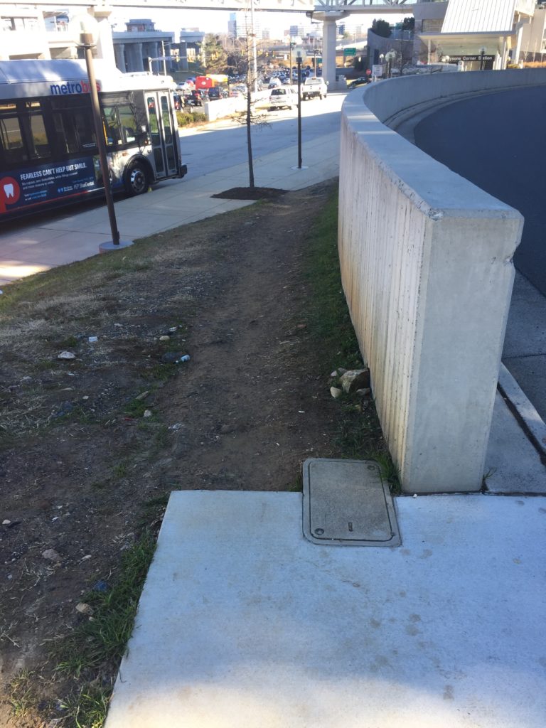
There are two main things that can get in the way of someone walking in Tysons, and they both tend to be larger here than in America’s older cities: streets and buildings.
The single block containing Tysons Corner Center measures almost half a mile, equivalent to about half a dozen blocks of downtown D.C. To walk around Tysons’ ‘superblocks’ is a long journey, but if paths are carved through them, these paths multiply the number of five- or ten-minute trips available to pedestrians.
Similarly, bridges and crosswalks also function as multipliers by connecting sidewalk networks. When a pedestrian bridge connected the Towers Crescent office building to Tysons Corner Center, it not only meant that 3,000 employees could walk to a variety of food options for their lunch hour, taking their cars off the road, it connected them to an expanding network of comfortable pedestrian infrastructure reaching beyond the Metro station.
A successful project
When sidewalks opened last month along Leesburg Pike under the Chain Bridge Road overpass, the project was successful because it observed all three of these guidelines.
First, there was demand. As one reader, Ryan, observed in the comments section, “Commuters were walking in the street for a few years, before we had this new sidewalk.”
Second, it was near transit, adjacent to the Greensboro Metro station.
Third, it provided a link between two previously-disconnected sidewalks, meaning that it didn’t only add pedestrian potential but multiplied it.
")
A new project is underway to make Tysons East a little more walkable.
The Scott’s Run Trail will provide a half-mile trail connecting Westgate Elementary School to the McLean Metro Station. The planned trail runs through the heart of Tysons East.
The path is planned to have an eight-foot-wide pedestrian walkway and two pedestrian bridges over the stream. The project’s aim is to facilitate pedestrian access to the McLean Metro for residents in the southern section of Tysons East, like the Pimmit Hills neighborhood.
Plans for the project date back to the Tysons Metrorail Station Access Management Study in 2011, and it was approved by the Board of Supervisors as part of a transportation priorities plan in 2014. The project recently opened for construction bids, which will be collected until March 5 and opened publicly that same day.
The total estimated cost of the project is $3.3 million funded by the Federal Regional Surface Transportation Program (RSTP).
Another trail pedestrian-bicycle trail is planned nearby to connect Tysons East with Tysons Corner Center.
Photo via Fairfax County Department of Transportation
")
A new sidewalk was recently completed in a McLean suburb, connecting the newly renovated Dead Run Stream trail to the nearby residential communities.
The new five-foot wide sidewalk runs for 400 feet. The project also added new curbs, gutters, curb ramps and pavement modifications.
")
Part of the improvements included improving the area’s drainage system to meet requirements related to the local watershed and to support the installation of the nearby walkway.
In addition to pedestrian improvements, new signage and pavement markings were added to enhance vehicle and pedestrian safety. Dense overhanging limbs of nearby trees were trimmed down too to improve visibility at the intersection.
Have you seen the new #walkway on Baron Road? The County installed #sidewalk from the Dead Run trailhead to Douglass Drive, which had been a dangerous segment of roadway for pedestrians. This awesome project provides a connection to downtown #McLean for nearby neighborhoods. pic.twitter.com/TjeAf7U6bR
— John Foust (@johnfoustva) February 19, 2019
Sidewalk photo via Twitter. Map via Fairfax County Department of Transportation
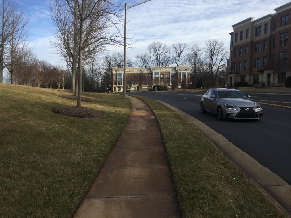
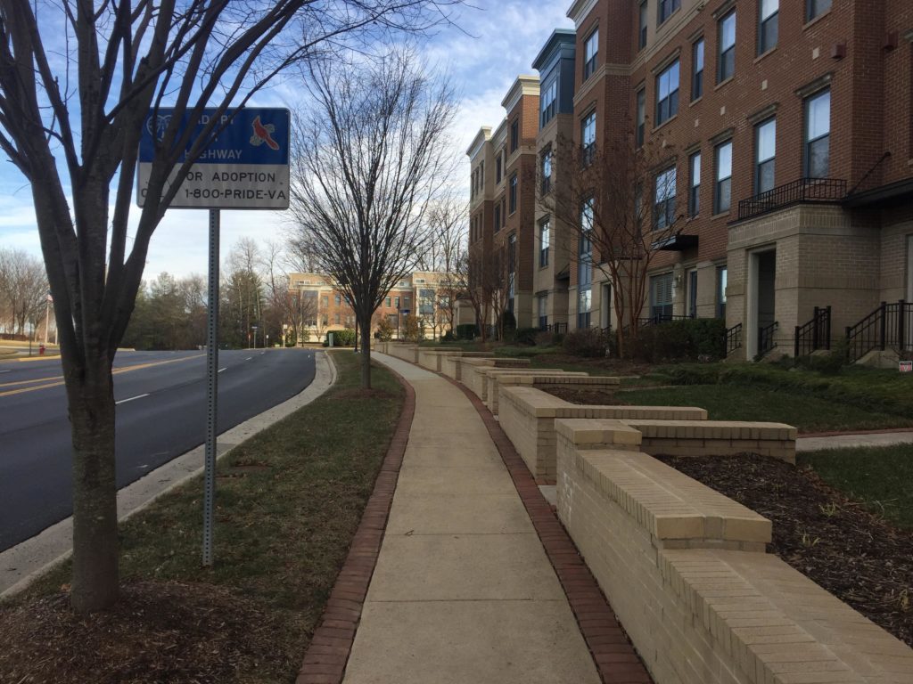
More and more sidewalks are coming to Tysons, but not all of them are created equal.
Sidewalks have been getting a lot of attention lately, They’re credited with the power to revitalize the economy and save lives, but sidewalks, like all infrastructure, need planning, engineering and investment — and some are implemented better than others.
Modern designers understand the subtleties of how to make a sidewalk safe and comfortable, while exciting new materials offer new technological possibilities and economists are coming to better understand the investment potential of sidewalks.
The best tools in any arsenal are multitaskers, and sidewalks aren’t just for moving. Just like we use streets for both driving and parking, we use sidewalks both for walking to a destination and also for standing still once we arrive.
In dense residential areas, like The Boro or The Mile, sidewalks can provide an outdoor common space, like a shared living room, for those living in small apartments. Sidewalks are also a good investment — they contribute thousands of dollars to property values. Good sidewalk design can even make a street safer for drivers.
Anatomy of a Sidewalk
The National Association of City Transportation Officials has a lot to say about how to engineer sidewalk space. In its design guide, it carves sidewalks up into three parallel zones – and while all three are for people, only one is actually about walking.
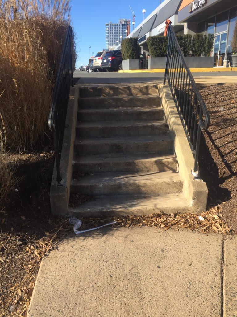
The frontage zone meets the facades of buildings and functions as an extension of them. It is usually home to cafe seating, benches, signs, staircases and entry ramps, and in residential areas individuals’ front gardens.
It can provide small nooks where you can stand under an awning and fire off a text message, or a place for eager customers to wait in line at the hip new cupcake shop. The frontage zone, while public, feels most closely associated with the building it touches.
The through zone is where pedestrians actually travel. It’s a clear lane for foot traffic, extending straight across multiple blocks, free of obstructions and wide enough for wheelchair users or groups of walkers to pass one another. It is often distinguished from the other two zones by a slightly different paving material. In order for pedestrians to move quickly, comfortably and efficiently, the through zone must be wide (at least five feet and up to 12) and unobstructed.
The furniture zone, also called the curb zone, is both the access to and the barrier from the street.
Traditionally, it is home to trees, light posts, traffic signs, utility boxes, newspaper stands and bus stops. In the 21st century, it gives us access to our wealth of new mobility options: car rental kiosks, Capital Bikeshare stations, pick-up zones for Uber or Lyft. This is where shared scooters ought to be parked.
Like the frontage zone, it can have benches or picnic tables, but this space feels entirely public, whereas benches in the frontage zone seem to belong to the adjacent building. The objects, furniture, and especially trees in this zone protect pedestrians from car traffic but the bus stops, taxi stands and bikeshare stations let them enter it on their terms. Like the wall of your house with its doors and windows, it protects you from the elements while also forming a point of access.
All sidewalks have these three zones, although they might blur together or be very narrow. Designing a good sidewalk, though, means understanding the role of each. Many sidewalks in Tysons, for lack in investment, don’t have the essential elements that fully flesh out the frontage and furniture zones. These sidewalks, simple concrete paths through grass, are incomplete.
Sidewalk Engineering
Concrete is classic, but new materials offer exciting possibilities for the sidewalks of the future. New kinds of sidewalks could double as automatic storm drains, use recycled materials, or generate electricity — and the D.C. area is on the cutting edge.
Engineers in many cities around the world have started experimenting with using recycled rubber as a paving material for the last two decades. Results have been mixed, with maintenance costs higher than expected in some places, but the rubber has a threefold advantage. DC has been a national leader with this technology, meaning Tysons has a lot of local expertise to reference.
First, by reusing waste rubber, the material is ecologically friendly.
Second, this rubber paving is usually slightly porous — meaning it absorbs some water during a heavy rainfall, helping deal with the thorny problem of stormwater management and preventing puddles from accumulating.
Third, as trees on sidewalks grow, their roots can push up and out, dislodging cement blocks and making the through zone inaccessible to those in wheelchairs. Rubber paving, because of its flexibility, can actually accommodate shifts in root structures without cracking.
Another new type of sidewalk has only made its way out of the laboratory a few years ago. In 2013, the George Washington University campus in next-door Loudoun County unveiled the world’s first walkable solar-powered pavement. This “Solar Walk,” part of the public campus sidewalk, uses solar panels embedded beneath a reinforced material to generate electricity that can not only light the sidewalk up at night but also send some power back to nearby Innovation Hall.
However, these flashy technologies have their critics, and it may be that traditional bricks offer greater value and some of the same benefits as the rubber material.
")
After years of petitioning and planning, it looks like Wolftrap Elementary will finally be getting some long-requested sidewalk upgrades.
The school was included on a list of transportation alternatives project submissions from the county to receive state grants. The Wolftrap Elementary School Crosswalk Improvement Project was awarded a $200,000 grant, with a local cash match of $50,000 approved at yesterday’s (Tuesday) Board of Supervisors meeting.
According to the staff report:
The extreme width of the roadway encourages illegal passing of vehicles stopped for children in the crosswalk, whether manned by the School Crossing Guard or not. The project consists of 7-foot to 15-foot bump outs and an 8-foot median refuge for the crosswalk (including evaluation for potential pedestrian beacon device), and creation of a channelized southbound right turn lane, on-road bike lanes, and transitional median striping as road diet treatments.
Wolftrap Elementary is at the heart of the residential network between Vienna and its namesake Wolf Trap National Park to the north, but despite this prime location for walkability, the school can be a challenge.
There is currently only one crosswalk to the school across the busy Beulah Road and only one narrow, cracked sidewalk. The other side of the road drops off into a ditch or undergrowth.
According to the school’s Parent-Teacher Association website, traffic on Beulah Road has increased over the last few years as GPS applications have increasingly directed drivers onto the once-quiet street into a shortcut from the Dulles Toll Road to Route 123 as part of an unofficial mini-beltway around Tysons. As county staff stated in their report, the PTA website indicates local parents witnessed the same issue.
“It is safest to cross if our crossing guard is present, but unsafe before and after her approximately 15-20 minute shift in the mornings and afternoons,” the PTA said. “Some drivers even ignore her, driving through the crosswalk when she directs cars to stop.”
The PTA website also indicated that cars frequently speed around the site, empowered by unclear speed limit signage.
“Cars are driving very fast, and the speed limit is ambiguous, either 25 or 35 mph,” the PTA said. “The speed limit is only definitively 25 mph when the lights are flashing around the time of morning arrival and afternoon dismissal from school.”
The PTA said the heavy traffic and unsafe crossing conditions currently confines traffic across the intersection to the few hours where it is monitored by a crossing guard.
Under the agreement, the county will manage the construction and maintenance of the improvements.
Photo via Google Maps
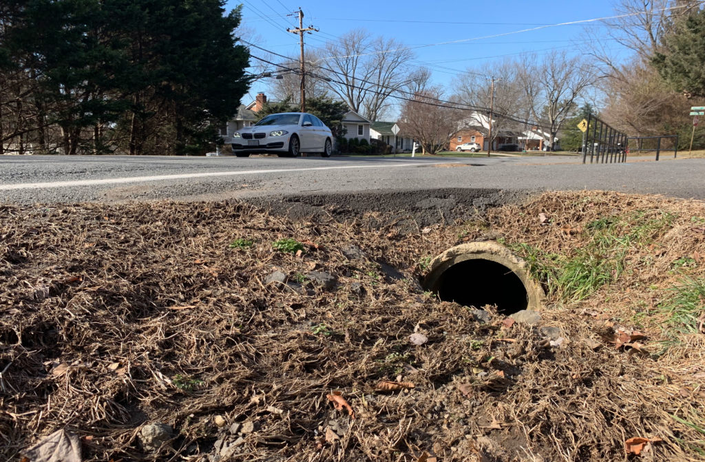
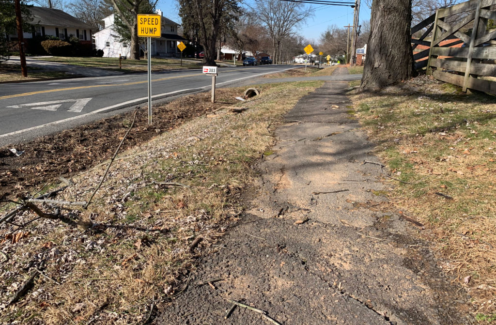
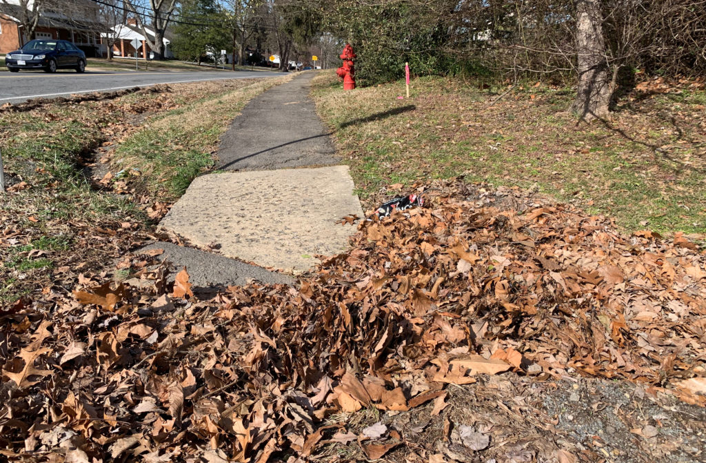
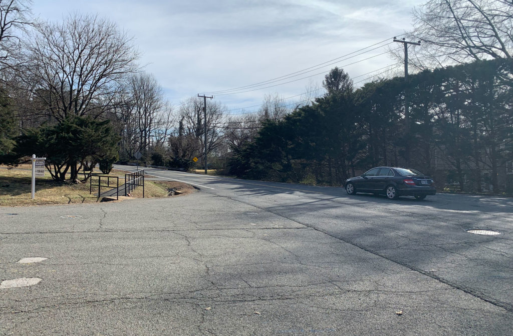
A busy stretch of street connecting Vienna to Tysons could be the next spot around the area to become a bit more pedestrian friendly.
At tonight’s Vienna Town Council meeting, the council is scheduled to vote on a $2.4 million project to build a new stretch of sidewalk, curbs, gutters and drainage along Old Courthouse Road. According to the construction agreement, the Town of Vienna would pay $550,000 while Fairfax County would pay $1.7 million.
The new improvements are planned to be installed on the north side of Old Courthouse Road from Westbriar Court (near Westbriar Elementary School) running as the street leads into Tysons, ending just behind the Tysons Square and Pike 7 Plaza shopping centers.
")
Katy Simenson, who has lived at the top of the nearby hill since 1960, was taking advantage of the nice weather to walk around the neighborhood. Simenson said the as long as the new improvements aren’t too overbearing, they’ll be a welcome addition to the little residential spot between the town of Vienna and its towering neighbor Tysons.
“It’ll be really appreciated,” said Simenson. “When there’s heavy rain, it runs down the hill behind these houses. It goes down through the big pipes under the road and floods along Old Courthouse Road.”
Simenson said as much as she’ll appreciate the new nearby sidewalk, the neighbors closer to Tysons will be the biggest beneficiary. Simenson noted that cars often come quickly down the hill, and there’s very little protection for nearby pedestrians. Just one block north of the improvements, a pedestrian was killed last year as he was crossing the street to help his wife.
Map via Town of Vienna