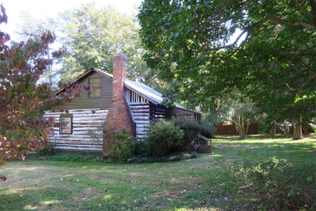
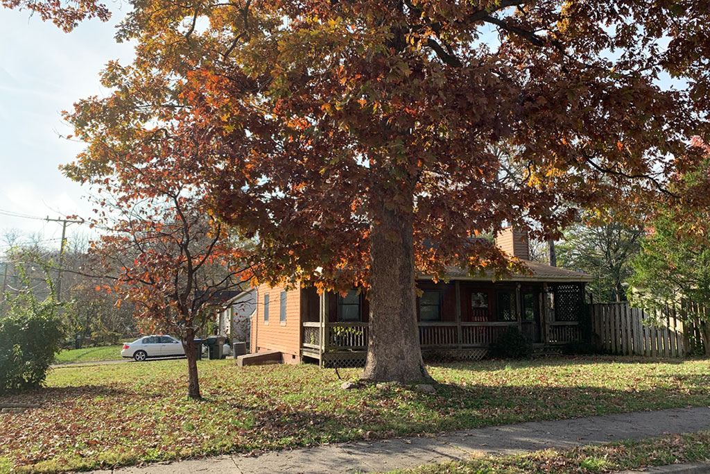
A Vienna log cabin, which may or may not be historic, could be demolished soon as the plot its on is subdivided.
The Vienna Town Council is scheduled to vote tonight (Monday) on whether or not to approve the subdivision. Staff recommended approval, but the building’s historic value is still under discussion.
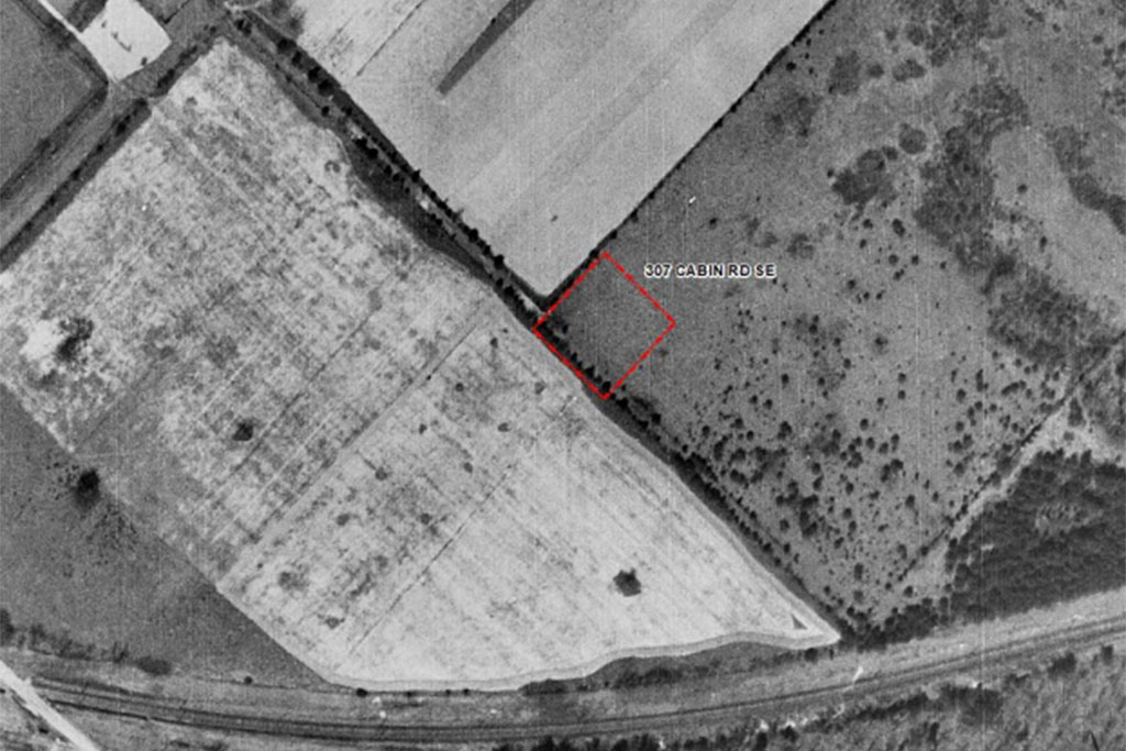
County tax records say the cabin was constructed in 1925, but the staff report notes that aerial photography from 1937 shows the lot being empty. In a letter to the Town Council, Michael Gelb, Chairman of the Planning Commission, said that Historic Vienna had expressed an interest in exploring more preservation or commemoration options for the site. According to Gelb:
No neighbors appeared at the Planning Commission meeting regarding the proposed subdivision, but Gloria Runyon, a representative of Historic Vienna, said the log structure may have historic value and that Historic Vienna wants to explore preservation/commemoration options. Ms. Runyon noted that the structure was erected by an African-American resident of Vienna. Historic Vienna had just learned of the proposed subdivision so did not have a specific proposal. She did not oppose the subdivision, but said Historic Vienna would like to work with the builder (American Signature Properties) and the Town on some type of recognition for the structure.
The cain is located at 307 Cabin Road Southeast. The one-and-a-half story building is bordered by five single-family detached dwelling lots. The applicant proposes making improvements to the property frontage, including a new sidewalk, curb and gutter.
Gelb also noted that while the Planning Commission voted unanimously to recommend approval of the subdivision, commission members had expressed concern about the fate of the log cabin. Gelb said Fred Eisenhart of American Signature Properties, the property developer, said that since the structure was not a registered historic property there were no legal restriction protecting it.
“Mr. Eisenhart said the company would talk with Historic Vienna, but some Commissioners voiced doubts about the depth of his commitment,” Gelb wrote in his letter. “Mr. Eisenhart responded that he did not mean to convey a lack of enthusiasm, but Commissioners agreed that the Chairman should note their concerns in this memo.”
Tysons East has been in the spotlight a lot lately.
Apple is eyeing Scotts Run, a development in Tysons East, as a potential new office location. Greater Greater Washington just profiled the neighborhood, calling it a “glitzy, suburban” area that may someday be a haven for “creative class” professionals.
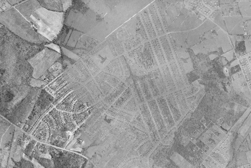
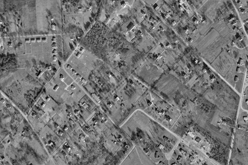
Like we did with Tysons Corner Center mall and Maple Avenue in Vienna, we’re using Fairfax County’s aerial photography maps to explore the history of the still-expanding Tysons East.
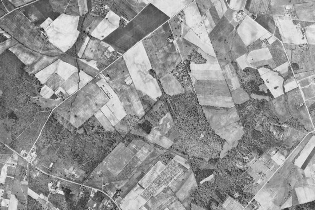
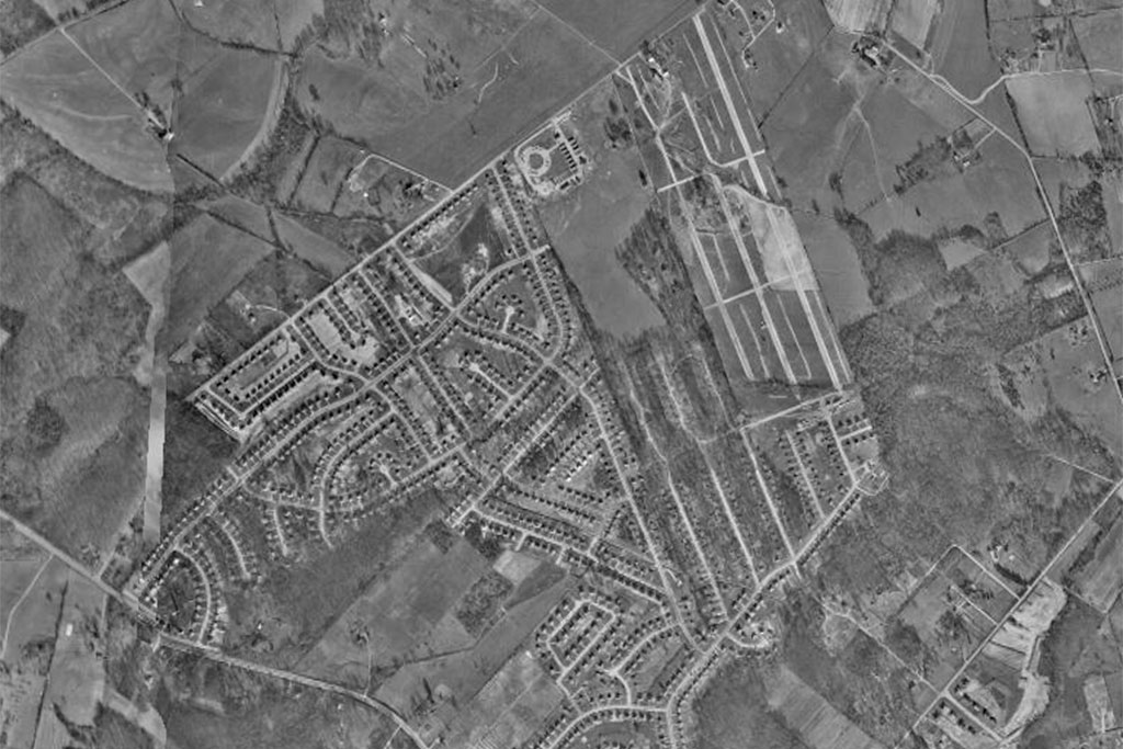
The earliest photography in 1937 shows the area as plots of farmland. The first development at the site was Pimmit Hills, built in the 1950s as a home for veterans of World War II and the Korean War. The photography from 1953 shows the neighborhood still in development, and by 1960 it had taken the general shape it still exists in today.
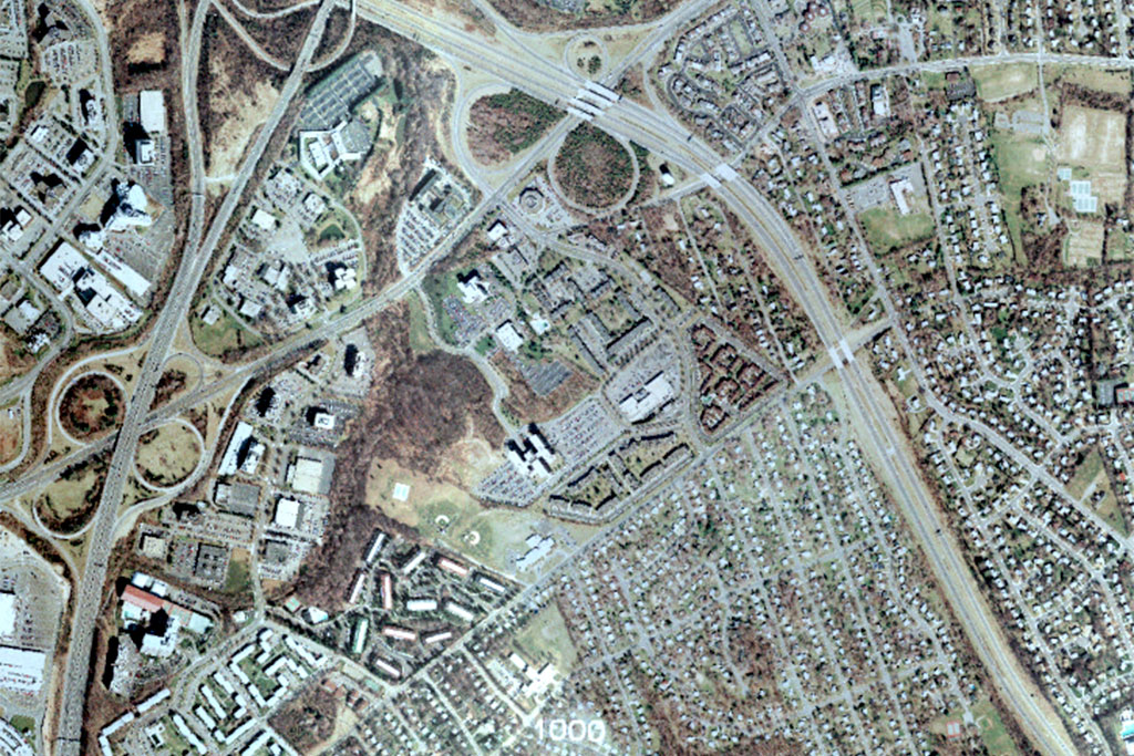
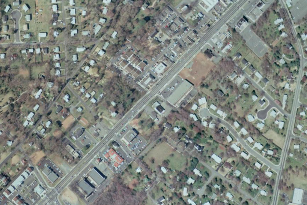
From there, the story of Tysons East’s development moves north. In the 16 years between 1960 and the photography from 1976, the area north of the Pimmit Hills exploded with new development. The construction of the Capital Beltway in 1964 and the construction of the Tysons Corner Center mall in 1969 helped spur new development in the area.
The aerial photography from 1990 shows continued growth in the area. In 1985, the Dulles Toll Road was extended from the Beltway to I-66, completely surrounding Pimmit Hills and the Tysons East development with major highways.
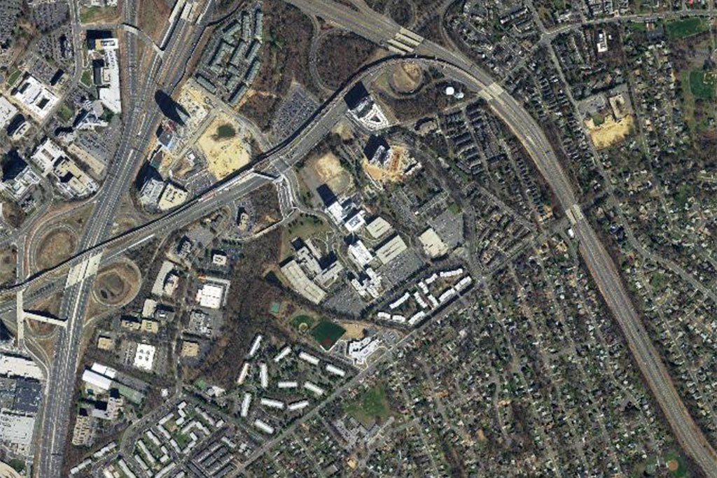
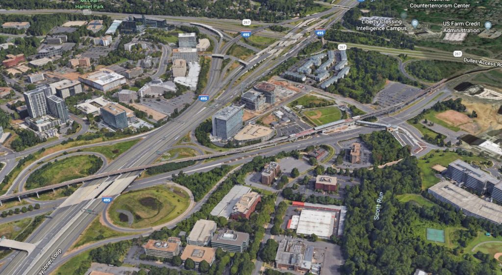
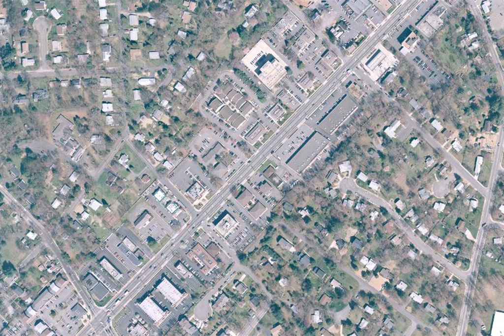
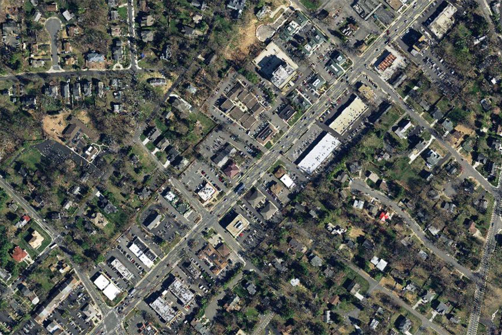
The largest change between 1990 and 2017 is the redevelopment of the smaller office buildings into major corporate campuses. Photography from 2017 shows areas of the Capital One complex, like the Capital One Tower, still under construction. Professor Stephen Fuller, Professor of Public Policy at George Mason University, said the complex is likely to be an anchor for new development in Tysons East.
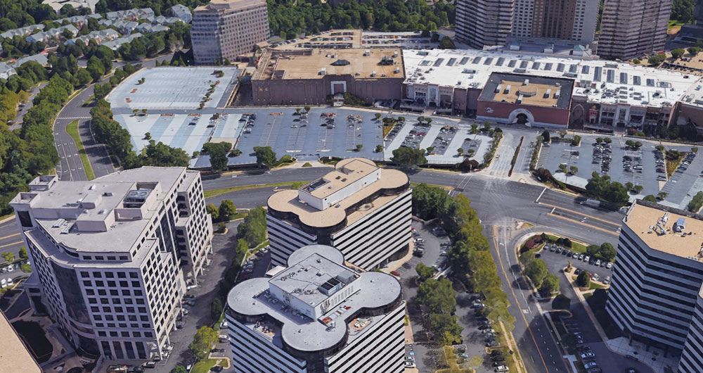
Photo (7) via Google Earth
(Updated at 8 a.m.) To the casual viewer, Pimmit Hills is a sleepy subdivision just southeast of Tysons quickly being overshadowed by its neighbor. But Pimmit Hills is a neighborhood with a surprising depth of history and one that played a central role in much of the region’s development.
In her new book, “Participation, Community and Public Policy in a Virginia Suburb“, Patricia Donahue, a policy fellow at George Mason University’s Schar School of Policy and Government, follows the neighborhood across sixty years of history.
On Nov. 10, the book was awarded the Ross Netherton Prize, a $1000 prize awarded for a work covering local history.
Donahue said the book started almost ten years ago when she was researching public policy impacts on small neighborhoods.
“I looked for a community in Northern Virginia that I thought was typical of a middle-income community in the post-war era,” said Donahue. “I thought it would be a simple case study, but it just kept unfolding into one fascinating story after another. It really told the story of suburbia in one community.”
Pimmit Hills was built as a subdivision in the 1950s for veterans of World War II and the Korean War. Though today it is dwarfed by nearby development, when it was first built it was the largest subdivision in Fairfax County by far; four or five times larger than any of the others.
When it was first built, the neighborhood was surrounded by farms and fields, but today it’s completely surrounded by highways and development. Donahue compared it to real estate holdouts in major cities.
Donahue said it was fascinating to follow the same community, and often same families, through the turbulent latter half of the 20th century through today.
“So much happened there,” said Donahue. “They dealt with desegregation, [growing] infrastructure, the baby boom… they were part of Fairfax transforming from a rural community into an urban one.”
Donahue said she stumbled on various extreme viewpoints from people who were essentially neighbors. The topic of segregation was one that had bitterly divided the community.
“There were people who supported massive resistance to desegregation, with residents who were very comfortable using language we find tough,” said Donahue. “But at the same time, in the same community, there were three ministers who made a public statement six months after the Montgomery bus boycott saying they totally rejected segregation and they wouldn’t let their churches support it. In one community, it’s a whole range of views. People risking their careers and people who were like ‘there’s no way we’re going to let this happen.'”
Beyond just segregation, Donahue said there were some horrific crimes throughout the neighborhood’s history as well. During the 1960s, Pimmit Hills was a pseudo-headquarters for The Pagans, a notorious motorcycle gang. In 1970, members of The Pagans kidnapped rival gang members, tortured them in Arlington, then murdered them in the forest near Pimmit Hills.
Pimmit Hills also played a surprising role in regional and national history. Donahue said Charles Lewis, one of the early presidents of the Pimmit Hills Citizens Association, was a researcher on the first American exploration of Antarctica. Frances Lanahan, a journalist and daughter of novelist F. Scott Fitzgerald, once wrote a profile of the neighborhood.
But one of the most notable moments for Pimmit Hills was in the early 1950s when Fairfax County signed up to be one of the first large-scale tests for Jonas Salk’s new polio vaccine. After gossip columnist Walter Winchell alleged that the polio vaccine would end up killing children, Donahue said many other communities yielded to concerns and pulled out of the tests. But given the high mortality rate of polio in Fairfax, Donahue said the county was the only community to stay in the program.
“Imagine the courage of those families who agreed when no one else would to have their children immunized,” said Donahue. “Second graders in Pimmit Hills were among the first in the nation to get the vaccine.”
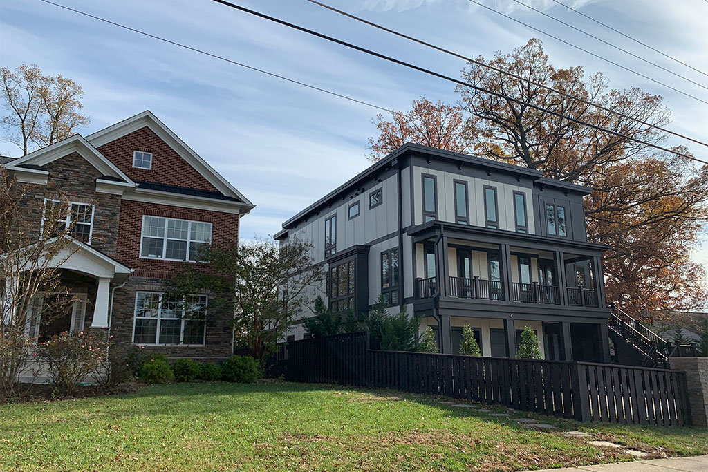
Whether the neighborhood can survive with new development pressures all around it remains in question. Donahue says she believes the neighborhood will continue to adapt and continue to survive.
“Like a lot of communities, they struggled with ‘hey, do we want development on our doorstep?'” said Donahue. “That’s still a struggle. Will they survive? I think they’re part of the change. If you drive through Pimmit Hills, every fourth or fifth house is a rebuild. They are changing it. I think they are not going to be bystanders in this change. They are going to be active agents in shaping that change.”
The book, which is intended for an academic audience, is currently listed at $89.98 on Amazon.

Toys for Tots Campaign Begins Today — “The Fairfax County Fire and Rescue Department is accepting donations for the Toys for Tots campaign from Nov. 19 to Dec. 12. Individuals can drop off new, unwrapped toys at any county fire station during the period. Last year, the initiative resulted in the collection of more than 14,000 toys.” [InsideNova, Fairfax County Fire & Rescue]
Dancing Stars Gala Raises >$250K — “On Nov. 10, the fifth annual DC’s Dancing Stars Gala netted more than $250,000 for local charities, bringing the event’s 5-year total to $1.3 million. The event was hosted by co-founders and co-chairs Maria Coakley David and Jim David at The Ritz-Carlton, Tysons Corner and featured seven local Celebrities, four Corporate Challenge Dancers and one Alumni Dancer who have spent the past several months training for Saturday night’s performance.” [Fairfax Times]
Vienna Planners Urge Developer to Save Cabin — “It’s not technically a certified historic structure, but the log cabin at 307 Cabin Road, S.E., in Vienna gave the street its name and was built by an African-American. The Vienna Planning Commission on Nov. 14 unanimously recommended the Vienna Town Council approve plans by Signature Properties to build a two-house subdivision on the 0.52-acre property, but urged the developer to work with local history advocates to save the cabin, if possible.” [InsideNova]
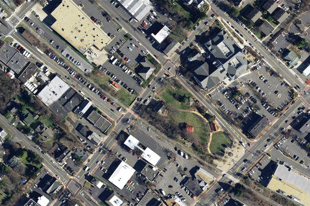
Maple Avenue can be famously slow to change, and it’s left Vienna with rampant vacancies in the middle of a region seeing a surge of new development.
But aerial photography shows this hasn’t always been the case. Throughout the last 65 years, Maple Avenue has undergone a radical transformation.
Critics of a new four-story Maple Avenue development said too much was changing in Vienna too quickly, but at least from the air, the only 20-year period where there’s been very little change along Maple Avenue was between 1997 and 2017.
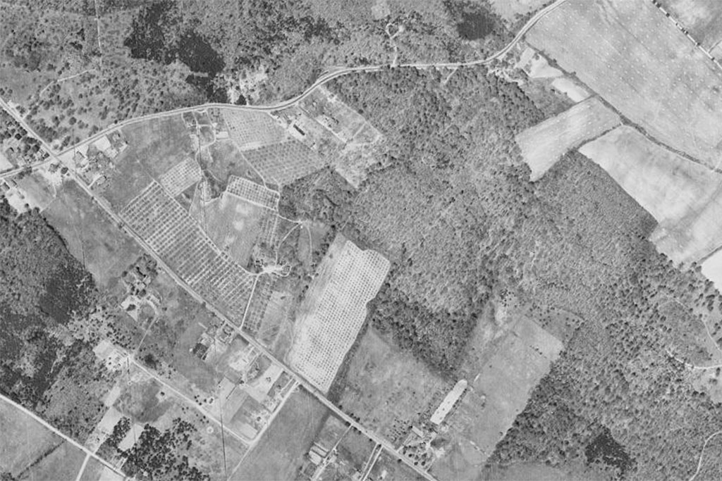
The Maple Avenue of 1953 looked quite different than the Maple Avenue of 1976. Maple Avenue transformed from a handful of small properties surrounded by farmland into islands of commercial property surrounded by residential streets.
Between 1976 and 1997, the gaps between those islands of commercial property had become filled in with smaller stores.
But the 1997 Maple Avenue is virtually identical to the 2017 Maple Avenue.
One of the most high-profile developments in downtown Vienna’s recent history was the establishment of the Town Green and redevelopment along Church Street, which runs parallel to Maple Street. The changes made there were cited by Vienna Town Council members during hearings for the controversial development — which was ultimately approved — as examples of ways development can still fit with a small town feeling.
Past and Present is a Tysons Reporter series looking at locations in our area as they’ve changed over the last century. Check out our articles for Tysons Corner Mall and Tysons Galleria/Leesburg Pike
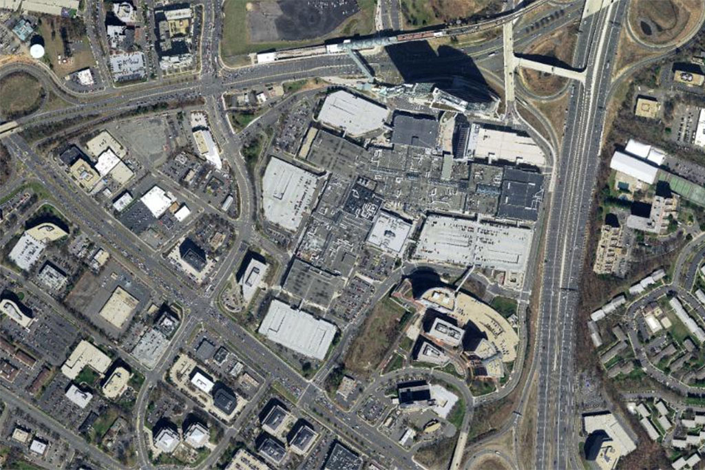
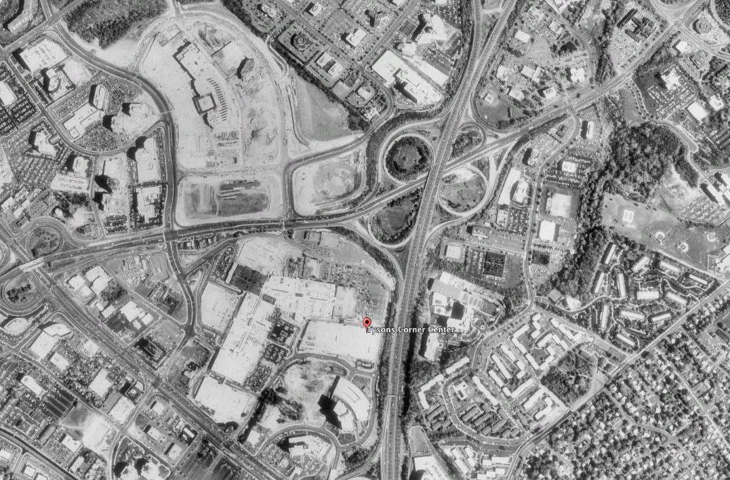
Tysons may be in a long–running effort to drop the “Corner” from the name, but the Tysons Corner Center mall is still the most iconic location in the area. It’s a corner that has gone through some substantial changes over the years.
The mall celebrated its 50th anniversary this year. The Fairfax County Historic Imagery Viewer, which collects aerial photography of the county over time, shows the mall’s evolution from a grassy field to a sprawling urban center. As we did with development near Tysons Galleria and the Greensboro Metro station, we’re sharing a glimpse of Tysons Corner Center over the years.
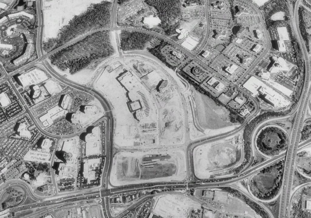
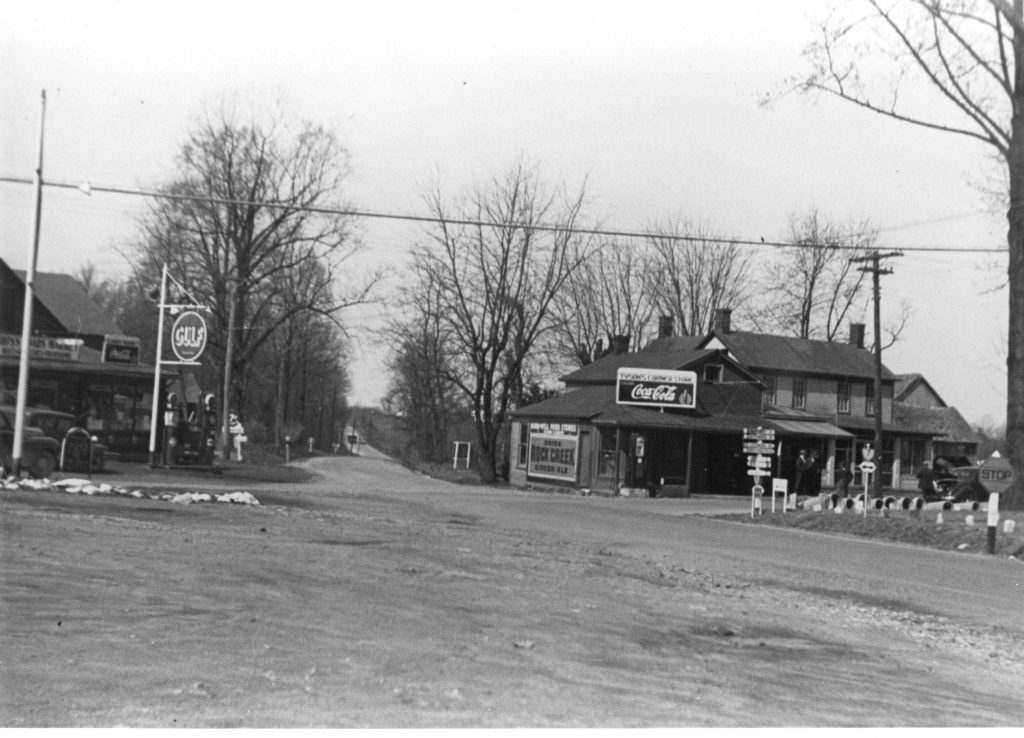
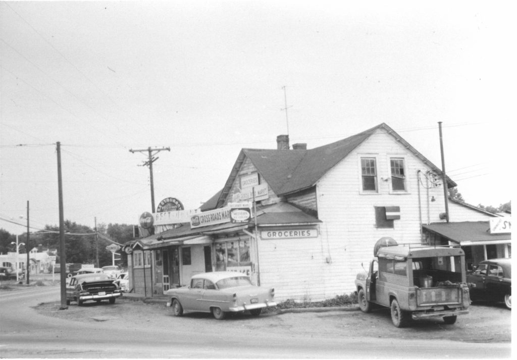
The oldest photos date from 1937, when the area was more cows than people. The area was known as Tysons Crossroads, with the main local stores being Crossroads Market and Tysons Corner Market.
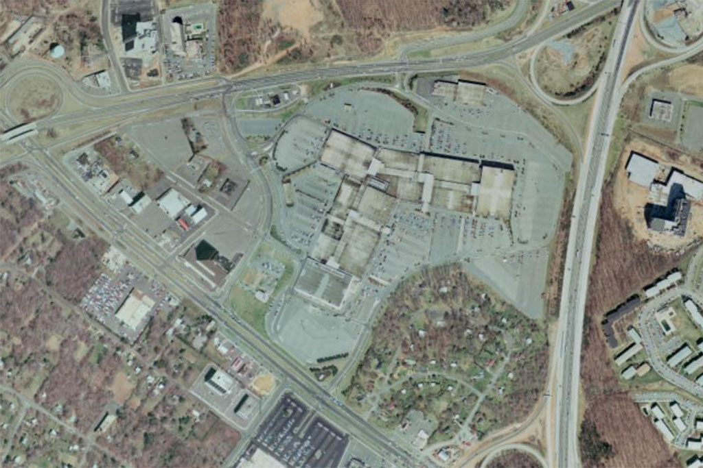
In 1976, the aerial photos shows the beginning of substantial changes in the area. The mall, constructed in 1969, had already started spurring some small development across Leesburg Pike. Also new in the 1976 photo is the Capital Beltway east of the mall, which was completed in 1964.
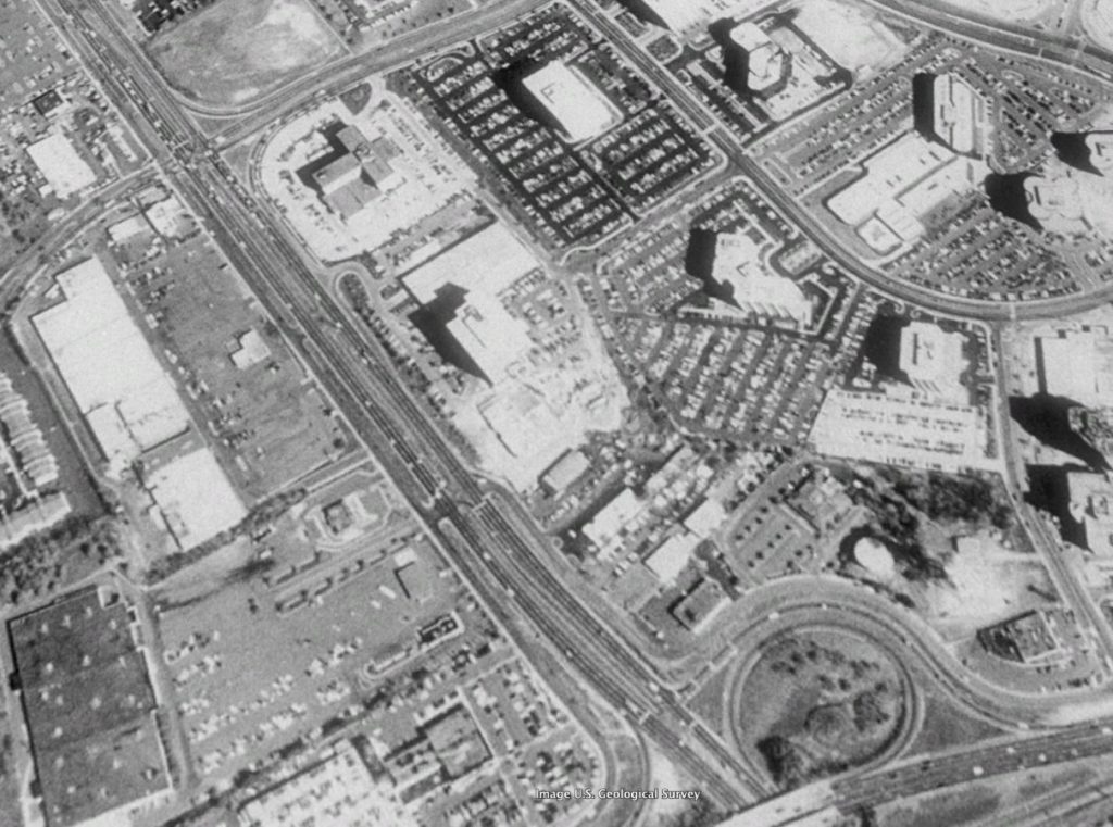
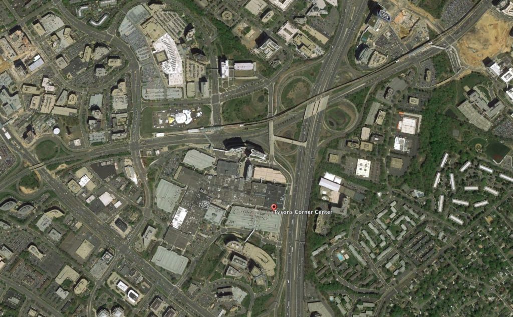
By 1990, the development across Leesburg Pike had continued apace. To the south, development of the Towers Crescent was still nearly ten years away. The mall itself had also undergone expansion in 1988, adding new anchor tenants like Lord & Taylor and Nordstrom.
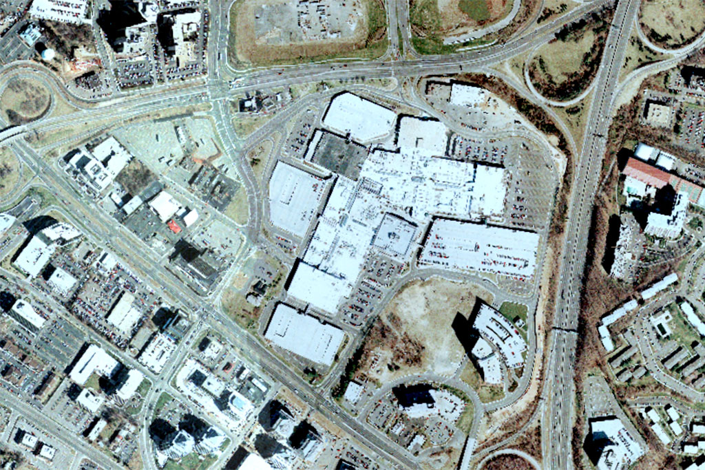
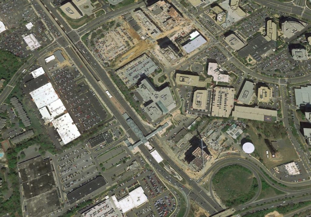
In 2017, one of the biggest aerial changes to the mall is the addition of the Tysons Corner Metro station located on Chain Bridge Road. The Towers Crescent development south of the mall also filled the space at the corner of the Beltway and Leesburg Pike, including the addition of tech firm MicroStrategy. In the wake of the announcement that MicroStrategy would be expanding its headquarters, the Towers Crescent developers are allegedly looking to sell the property.
The blistering pace of development in Tysons has many looking to the future, but sometimes it’s interesting to look back.
Aerial photos from the 1980s, available via Google Earth, help tell the story of the region’s evolution over the past three decades.
Tysons as an urban metropolis is a somewhat modern phenomenon for an area that was largely farmland for 100 years after William Tyson purchased it. In the 1960s, development was jump-started by the construction of the Capital Beltway, Dulles Airport, and the Tysons Corner Shopping Center in 1968.
By the 1980s, when the first satellite photos are available, Tysons was already a developed area. According to data from the U.S. Census, in 1990 the population of Tysons was 9,374. It grew by 35.8 percent to 12,734 in 2000.
The growth slowed a bit between 2000 and 2010, when the population rose by 11.2 percent to 14,159. Since then the pace of residential growth in Tysons has picked back up; the current population of Tysons is 19,627, already a 38.7 percent increase over 2010.
The 1988 image of Tysons, above, shows Tysons Galleria to the north on the eve of opening later that year. The streets surrounding Tysons Galleria were also widened and became more interconnected over the years, allowing for more dense construction to the north and to the east, including several recently opened and planned mixed-use developments. The offices to the west of Tysons Galleria are currently planned for major renovations to keep up with development further west on Leesburg Pike.
One of the most visually striking shifts on Leesburg Pike is the decrease in surface parking lots, which covered much of the office parks east of Leesburg Pike. Several of the lots have been replaced with under-construction developments like The Boro. The shopping centers west of Leesburg Pike have also become more active as well, with new restaurants like Honeygrow and Cava opening this year.
Photos via Google Earth
The term “Tysons Corner” is perhaps today most associated with Tysons Corner Center, the giant shopping mall turned mixed-use development that recently marked its 50th anniversary.
But in the 1850s, when William Tyson purchased land around the intersection of Route 7 and Route 123, the 35 stores that made up the original iteration of the mall were more than a century away. The area was known as Peach Grove, and then Tysons Crossroads. Well into the 20th century, the section of land today frequently known simply as Tysons remained rather undeveloped.
“There were more cows than people. Maybe not quite, but it was quite a rural place,” Stephen Fuller, the head of George Mason University’s Stephen S. Fuller Institute, said. “It changed dramatically and the key factor that changed it, [that] put it on the map was the Beltway.”
Already located at the intersection of Routes 7 and 123, the addition of the Capital Beltway, which first opened in 1961, made Tysons “sort of the nexus of auto transportation in all directions,” Fuller said.
On top of that, when Dulles International Airport opened in 1962, the Dulles Access Road ran 13.5 miles from the airport to Route 123 and the Beltway.
“That’s where Tysons Corner happened to be located, right where that access road stopped,” said Paul Ceruzzi, a curator at the Smithsonian’s National Air & Space Museum and author of Internet Alley, a book that documents much of Tysons’ history.
It wasn’t until 1983 that the access road would be extended to connect with I-66, which had just been completed through Arlington. Had the access road gone all the way to D.C. from the start, “Tysons Corner may never have happened,” Ceruzzi said.
Tysons’ advantageous location attracted “shrewd insight” from real estate developers, Ceruzzi said. “The landowners there were also savvy in that they allowed this development to proceed,” letting developers “assemble big parcels to assemble really high quality office buildings and other facilities.”
Early investors included Gerald Halpin, who in 1962 with partners purchased 125 acres of land in the Tysons area from dairy farmers, and Ted Lerner, whose triumphs include Tysons Corner Center and who with his family today is the majority owner of the Washington Nationals.
Also key to making developments in Tysons possible was Fairfax County. As early as October 1961, the Fairfax County Planning Commission presented the Tysons area as a possible regional center, as The Washington Post reported at that time.
That doesn’t mean growth always came easily. Lawyer and developer Til Hazel notably led people like Lerner through the legal process to make construction possible.
Ultimately, the initial rise of Tysons was the result of a “combination” of factors, Ceruzzi said — among them, the introduction of interstate highways, suburbanization after World War II, real estate development and proximity to the Pentagon, which “was generating these institutes and companies,” he said. “All of that kind of came together.”
Plans for the area’s future, in private and public realms, are still evolving. Today, Tysons is in something like the “third phase of its life,” Fuller said. “It was a retail center first, then it morphed into an employment center and now it’s becoming a mixed-use center with hopes it’ll become more livable.”
Next week, check back to read about some of the forces that have helped shape Tysons today, including Fairfax County’s Tysons Comprehensive Plan and evolving planning priorities.