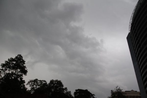
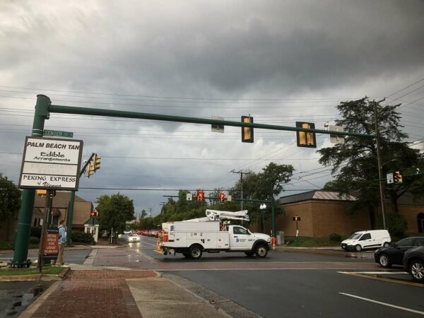
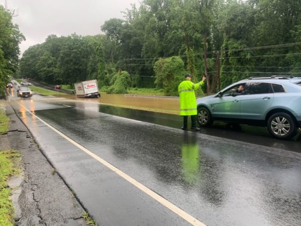
Updated at 4:25 p.m. — A Severe Thunderstorm Warning has now been issued for Fairfax County. In effect until 5 p.m., storms are moving east at 15 miles per hour with 60 mile-per-hour wind gusts that could bring down trees and large branches, potentially leading to power outages.
Earlier: Fairfax County is still in the process of recovering from last night’s storm, and the next one is already on the way.
The National Weather Service has put the entire D.C. region under a Severe Thunderstorm Watch until 9 p.m., warning of the potential for hail and damaging winds similar to the blasts that disrupted travel and power in the Vienna and Falls Church area yesterday (Tuesday).
A Severe Thunderstorm Watch has been issued until 9 PM this evening for all areas east of the Allegheny Front. Damaging winds and large hail will be the primary threat for these storms. pic.twitter.com/CXqq3C1nP4
— NWS Baltimore-Washington (@NWS_BaltWash) August 11, 2021
[8/11 at 2:15 PM] ⚠️A Severe Thunderstorm Watch is in effect until 9 PM tonight. Potential hazards from these storms include: damaging wind gusts, hail, lightning, and isolated flash flooding. Be prepared to move indoors and know what to do if a warning is issued. #VaWx #BeReady pic.twitter.com/4nGV078aXl
— Ready Fairfax (@ReadyFairfax) August 11, 2021
In addition, a Heat Advisory will remain in effect until 8 p.m. today with an Excessive Heat Watch scheduled to begin at noon tomorrow (Thursday), when the heat index could reach up to 105 degrees Fahrenheit.
Updated at 9:45 p.m. — Metro has restored service on the Orange Line between Vienna and East Falls Church after it was suspended earlier due to a power outage at the West Falls Church Metro station.
Earlier: A thunderstorm has taken out power for thousands in the Tysons area, particularly around Vienna, Falls Church, and Merrifield.
The National Weather Service issued a Severe Thunderstorm Warning for northeastern Fairfax County at 5:12 p.m., though by that time, the rumble of thunder had likely alerted anyone in the area.
Moving east at 15 miles per hour, the storm brought 60 mile-per-hour wind gusts, according to the NWS, which warned about the potential for fallen trees and large branches.
“This could injure those outdoors, as well as damage homes and vehicles,” the alert said. “Roadways may become blocked by downed trees. Localized power outages are possible. Unsecured light objects may become projectiles.”
The storm arrived quickly, leaving many unprepared.
Prob should have put the umbrellas down in Tysons. This poor guy. @nbcwashington pic.twitter.com/9SZTfvOlrd
— Adam Tuss (@AdamTuss) August 10, 2021
At least 51,423 Dominion Energy customers in Fairfax County are now without power, according to the site PowerOutage.US.
Dominion Energy’s outage map shows many of the outages concentrated in Falls Church, Merrifield, and Vienna, where businesses in the commercial area along Maple Avenue and Church Street were among those that lost electricity.
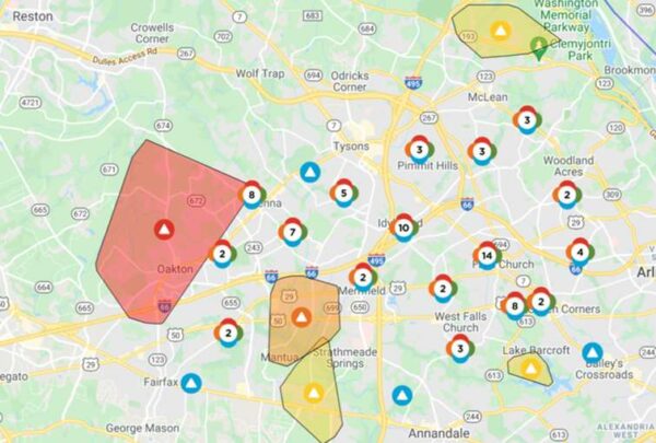
Dominion Energy generally estimates that power will be restored between 7 p.m. and midnight, though the cause of some outages is still under investigation. Most of the outages have been attributed to out circuits, but one affecting more than 5,000 people around Vienna and Oakton is the result of a tree falling on a power line.
Metro has suspended service on the Orange Line between Vienna and East Falls Church due to a loss of power at the West Falls Church station. The transit agency says shuttle buses have been requested.
Orange Line Delay: Train service suspended between Vienna & E Falls Church due to a power outage at W Falls Church. Shuttle buses requested.
— Metrorail Info (@Metrorailinfo) August 10, 2021
Power out in Dunn Loring too pic.twitter.com/xwAP95RWMY
— James Holcombe (@jameslholcombe) August 10, 2021
Even with the thunderstorm, Fairfax County can expect little relief from the summer heat and humidity over the next couple of days, with the heat index expected to surpass 100 degrees tomorrow and on Thursday (Aug. 12).

While temperatures in Fairfax County haven’t exactly been comfortable over the past couple of days, the heat is about get worse before easing up at the end of this week.
The National Weather Service has issued a Heat Advisory for the D.C. area, including Fairfax County, that will take effect from noon through 8 p.m. tomorrow (Wednesday). An Excessive Heat Watch will follow on Thursday (Aug. 12) over roughly the same time frame.
Forecasts indicate high temperatures of 95 degrees tomorrow and 99 degrees on Thursday in Tysons, but the addition of humidity could make it feel like more than 100 degrees.
Here is more from the alert:
* WHAT…For the Heat Advisory, heat index values will range from around 100 degrees west of Interstate 95 to around 105 degrees near and east of Interstate 95. For the Excessive Heat Watch, dangerously hot conditions are possible with heat indices possibly ranging from around 105 degrees west of Interstate 95 to around 110 degrees near and east of Interstate 95.
* WHERE…The Washington, Baltimore, and Fredericksburg areas, central and southern Maryland, northern Virginia, and the eastern panhandle of West Virginia.
* WHEN…For the Heat Advisory, from noon to 8 PM EDT Wednesday. For the Excessive Heat Watch, from Thursday afternoon through early Thursday evening.
* IMPACTS…Extreme heat and humidity will significantly increase the potential for heat related illnesses, particularly for those working or participating in outdoor activities.
The NWS advises preparing for the incoming heat by drinking plenty of fluids, staying out of the sun and in air-conditioned rooms when possible, and checking in on relatives and neighbors.
“Young children and pets should never be left unattended in vehicles under any circumstances,” the NWS says in the alert. “This is especially true during warm or hot weather when car interiors can reach lethal temperatures in a matter of minutes.”
A Heat Advisory has been issued for portions of our area Wednesday as increased heat and humidity will result in heat indices ranging between 100-105 degrees. Slightly hotter conditions expected Thursday, prompting an Excessive Heat Watch. https://t.co/JxQPRW87Gr pic.twitter.com/SbRldDZPPF
— NWS Baltimore-Washington (@NWS_BaltWash) August 10, 2021
Stay safe this summer and KNOW the symptoms of heat-related illness! ☀️🌡
⬇️Heat safety tips
💧Stay hydrated
🌳Find shade
👶Don't leave kids/pets unattended
🤝Check up on neighbors
🚗LOOK before you LOCKMore info
➡️https://t.co/mZEhRFo8WJ pic.twitter.com/TYUBzq7qWE— Supervisor John Foust (@DranesvilleSup) August 10, 2021
Photo via Ritam Baishya/Unsplash
Like much of the D.C. area, Fairfax County is now under a Severe Thunderstorm Watch that will be in place until 9 p.m.
The region is bracing for a second consecutive night of potentially damaging wind and rainfall after a storm that swept through late Wednesday (July 28) resulted in power outages that affected thousands of people in Fairfax County, particularly around McLean and Falls Church.
While many of the outages have been addressed, Dominion Energy’s outage map shows that, as of 3:30 p.m., crews are still working to restore electricity in some areas. The current estimated time of restoration for the lingering outages ranges from before 5 p.m. to 6-11 p.m.
A Tornado Watch has been issued for D.C.’s Maryland suburbs, but Fairfax County could see damaging hail, isolated flash flooding, and large hail from the incoming storm, according to the National Weather Service.
The Fairfax County Office of Emergency Management advises residents to “stay weather aware and know what to do if a warning is issued,” which would mean that severe weather is imminent or underway.
A Severe Thunderstorm Watch has been issued for areas outside of the Tornado Watch, both of which are until 9 PM tonight. Main threat for these storms will be for damaging winds, large hail, isolated flash flooding and tornadoes. pic.twitter.com/eNM7nyBtFK
— NWS Baltimore-Washington (@NWS_BaltWash) July 29, 2021
Storm Brings Power Outages, Hail to Fairfax County — Thunderstorms swept through Fairfax County last night (Wednesday), resulting in reports of damaging winds and even hail “that toppled trees and wires.” As of midnight, Dominion Energy’s outage map showed thousands of people in the county without power, particularly around McLean. [Capital Weather Gang]
Farmer’s Market Nonprofit Awarded State Grant — FRESHFARM will get a $50,000 grant from the Virginia Food Access Investment Fund to establish new fresh food mobile markets in food-insecure areas of Northern Virginia. The nonprofit operates several farmer’s markets in Fairfax County, including the ones at the Mosaic District and The Boro. [Patch]
More Traffic Control Sought for Great Falls Park — “Great Falls Citizens Association (GFCA) officials are seeking to have the federal government provide $100,000 in permanent, annual funding for U.S. Park Police to control traffic at Old Dominion Drive and Georgetown Pike outside the park’s entrance when park usage is especially heavy…Traffic congestion outside the park routinely occurs on weekends, holidays and fee-free days from March through early November, GFCA leaders said.” [Sun Gazette/Inside NoVA]
Madison HS Student Brings Books and Bikes to Tanzania — James Madison High School rising junior Sophia Brown organized a bicycle drive at the Vienna school in May and collected dozens of donated books to bring to Tanzania for a Girl Scout project. Sophia traveled to the East African country this summer with support from the nonprofit Wheels to Africa, which she has worked with since she was in second grade. [FCPS]
Tropical Storm Elsa Heads to Virginia — After leaving Florida behind, Tropical Storm Elsa is expected to bring heavy rain and strong winds along the East Coast from Georgia to New England through Friday. Forecasts show the storm passing to the east, but the D.C. area on I-95 could get some rain and breezy conditions tonight. [Capital Weather Gang]
Falls Church Developer Proposes More Senior Housing — “The Falls Church Gateway developer partnership getting underway with work on the 9-acre site of the former George Mason High School came to the F.C. City Council Monday with a request, granted a preliminary vote by a 7-0 margin, to expand the senior living building set for the site from 225,000 square feet to 260,000, including a height increase to 15 stories to accommodate up to 215 units.” [Falls Church News-Press]
Cause of Bird Deaths Still Unknown — The Virginia Department of Wildlife Resources received more than 1,400 reports of sick or dying birds in Northern Virginia, including Fairfax County, between May 23 and June 30. No cause has been identified yet, but symptoms of the illness include eye swelling and neurological issues. [Vienna Police/Twitter]
Travel Ban Puts Falls Church Couple’s Wedding Plans at Risk — “The pandemic has prevented a couple from Falls Church, Virginia, from walking down the aisle, and now they say they’ll lose $30,000 if the U.S. travel ban on citizens from Britain and other European nations isn’t lifted soon.” [WTOP]
McLean District Leads String of Vehicle Thefts — Fairfax County police have been investigating a series of stolen vehicle reports since early June. The incidents usually take place overnight and involve the suspects entering unlocked vehicles with the keys inside. The majority of thefts have occurred in the McLean District, which has 15 cases. [FCPD]
Tysons Boulevard Closure Delayed — Plans to close a section of Tysons Boulevard’s northbound lane for bicyclists and pedestrians have been postponed “due to a small delay in installation.” The temporary closure was scheduled to begin today (Tuesday) but will instead start next Wednesday (June 14). [Fairfax County Department of Transportation]
I-495 Ramps in Idylwood to Close Overnight — “The ramps from northbound I-495 to I-66 East and I-66 West are scheduled to be closed nightly Tuesday, July 6, through Thursday, July 8, from 11 p.m. to 5 a.m., and Friday night, July 9, from midnight to 4 a.m. for paving and implementation of a traffic shift…The I-66/I-495 Interchange is being rebuilt as part of the Transform 66 Outside the Beltway Project.” [VDOT]
Nearby: Tornado Touched Down in Arlington — The National Weather Service confirmed on Friday (July 2) that a tornado touched down during the thunderstorm that passed through the D.C. area the previous day. The twister charted a 4.4-mile path from northern Arlington to the National Mall and brought winds that reached 90 miles per hour. [ARLNow]
Updated at 3:50 p.m. — A Flash Flood Warning has been issued for Fairfax County until 6:30 p.m.
Updated at 2:45 p.m. — The Severe Thunderstorm Warning has been extended to 3:30 p.m., and the list of affected locations now includes Vienna and Falls Church.
Earlier: A Severe Thunderstorm Watch has been issued for Fairfax County and the rest of the D.C. area, joining a Flash Flood Watch that will take effect at 2 p.m. today (Thursday).
The thunderstorm watch took effect at 12:40 p.m. and will remain in place until 8 p.m., according to the National Weather Service.
A Severe Thunderstorm Warning has also been issued for the northeastern part of the county, including Wolf Trap and McLean around the American Legion Bridge. That will be in effect until 1:45 p.m.
The Severe Thunderstorm Warning from the NWS says:
* At 103 PM EDT, a severe thunderstorm was located over Ashburn, or near Broadlands, moving east at 25 mph.
HAZARD…60 mph wind gusts and quarter size hail.
SOURCE…Radar indicated.
IMPACT…Damaging winds will cause some trees and large branches to fall. This could injure those outdoors, as well as damage homes and vehicles. Roadways may become blocked by downed trees. Localized power outages are possible. Unsecured light objects may become projectiles.
* Locations impacted include…
Rockville, Bethesda, Gaithersburg, Reston, Olney, Herndon, Broadlands, Lansdowne, Lowes Island, Brambleton, American Legion Bridge, Aspen Hill, Potomac, North Bethesda, Ashburn, Sterling, North Potomac, Redland, Wolf Trap and Great Falls.
“For your protection move to an interior room on the lowest floor of a building,” the NWS advises.
[7/1 at 1:10 PM] A Severe Thunderstorm Warning has been issued until 1:45 PM. Seek shelter if you are outside.📍Impacted locations include: Reston, Herndon, Wolf Trap, and Great Falls. #VaWx https://t.co/IRoso825rm
— Ready Fairfax (@ReadyFairfax) July 1, 2021
A Severe Thunderstorm Watch has been issued for parts of DE, DC, MD, NJ, PA, VA until 8 PM EDT. #MDwx #VAwx #DCwx pic.twitter.com/2sf7WdTrtE
— NWS Baltimore-Washington (@NWS_BaltWash) July 1, 2021
The National Weather Service has issued a Flash Flood Watch for the D.C. area, including Fairfax County.
The alert will take effect at 2 p.m. tomorrow (Thursday) and last through 8 a.m. on Friday (June 2). Thunderstorms could bring up to four inches of rain in some locations.
Here is more from the alert:
* From Thursday afternoon through Friday morning.
* Several rounds of thunderstorms are expected Thursday afternoon through early Friday morning with localized rainfall rates of up to 1-2 inches per hour possible. Total rainfall amounts of 1-3 inches, with locally higher amounts up to 4 inches are possible.
* Heavy rain in short periods of time will cause the potential for streams and creeks to quickly rise out of their banks as well as the potential for flash flooding in urban areas.
“You should monitor later forecasts and be prepared to take action should Flash Flood Warnings be issued,” the NWS says.
According to the NWS forecast for Tysons, the storms are expected to bring the area’s temperatures from the 90s back to the 60-70 degree range for the weekend, setting the stage for a mostly clear, sunny Independence Day.
The rain just keeps coming.
While a Flash Flood Warning issued yesterday (Thursday) for the D.C. region, including Fairfax County, was canceled ahead of schedule at 7:15 p.m., the National Weather Service has extended the Flash Flood Watch that was set to end at midnight through today (Friday).
Issued at 3:03 a.m., the new alert will be in effect through this evening, as showers and thunderstorms are expected to bring two to four additional inches of rain to the area.
Here is the full alert:
…FLASH FLOOD WATCH IN EFFECT THROUGH THIS EVENING…
The National Weather Service in Sterling Virginia has expanded the
* Flash Flood Watch to include portions of Virginia and West Virginia, including the following areas: in Virginia, Clarke, Eastern Loudoun, Fairfax, Frederick VA, Page, Shenandoah, Warren and Western Loudoun. In West Virginia, Berkeley, Eastern Grant, Eastern Mineral, Eastern Pendleton, Hampshire, Hardy, Jefferson, Western Grant, Western Mineral and Western Pendleton.
* Through this evening
* Additional showers and thunderstorms capable of producing heavy rainfall amounts of 2 to 4 additional inches are expected to re-develop early this morning and persist into this afternoon.
* More heavy rainfall may cause additional flash flooding.
“A Flash Flood Watch means that conditions may develop that lead to Flash Flooding,” the NWS says. “Flash Flooding is a very dangerous situation. You should monitor later forecasts and be prepared to take action should Flash Flood Warnings be issued.”
The threat for flash flooding persists in the Mid Atlantic again today.
Each year, more deaths occur due to flooding than from any other thunderstorm related hazard – and half of those are the result of a vehicle being driven into floodwaters. #TurnAroundDontDrown https://t.co/ffxF3YDP4y
— National Weather Service (@NWS) June 11, 2021


