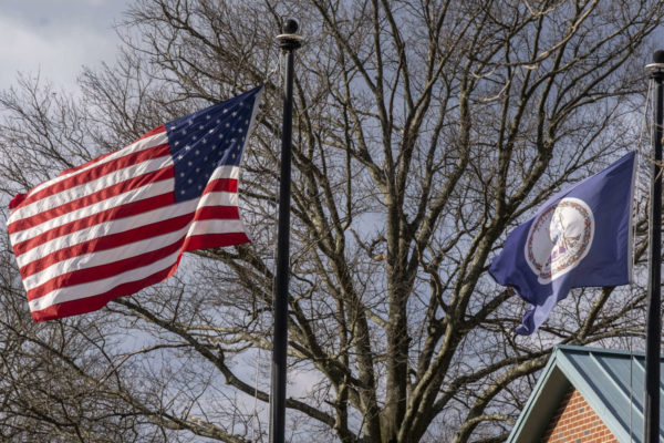
Fairfax County and the rest of the D.C. area could experience wind gusts of up to 50 miles per hour this afternoon.
The National Weather Service issued a Wind Advisory for the region last night that will be in effect from 2-6 p.m. today (Tuesday).
“Gusty winds could blow around unsecured objects,” the NWS said. “Tree limbs could be blown down. A few power outages may result.”
The Fairfax County Fire and Rescue Department advises securing outdoor objects and keeping electronic devices charged.
Wind Advisory for Fairfax County today from 2 PM-6PM. Winds 20-30 mph w/gusts up to 50 mph. Winds could blow tree limbs down and unsecured objects around. Power outages may result. Secure outside objects. Keep electronic devices charged. #FCFRD #weather https://t.co/bB46NZAHdV
— Fairfax County Fire/Rescue (@ffxfirerescue) February 23, 2021
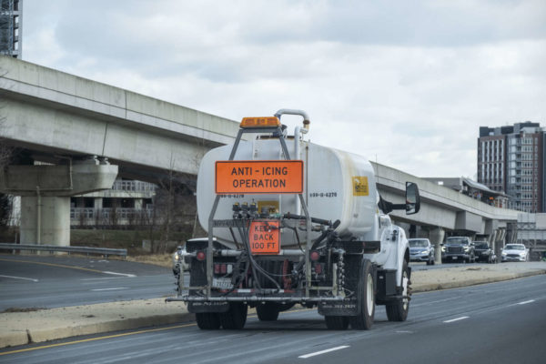
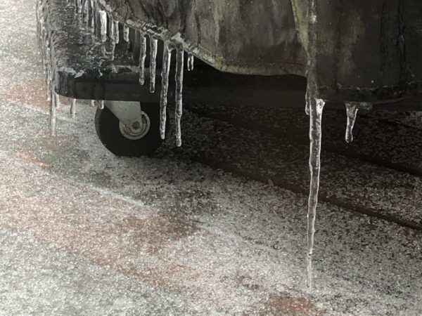
The wind advisory comes as refrozen ice lingering from yesterday’s snow and sleet wreak havoc on local roads. The Virginia State Police reported shortly after 7 a.m. that its troopers had cleared 13 traffic crashes since approximately 4:15 a.m. and were in the process of investigating another 32 crashes in the Northern Virginia region.
“The majority of the crashes have involved only damage to vehicles. No fatal traffic crashes reported,” VSP Public Relations Director Corinne Geller said, advising drivers to slow down and watch for black ice this morning, especially on overpasses and bridges.
In Fairfax County, first responders were on the scene of a two-vehicle crash on Leesburg Pike over Columbia Pike in the Bailey’s Crossroads area of Falls Church around 7:45 a.m. Ice blocking the westbound left lane further contributed to travel delays.
Staff Photo by Jay Westcott
The National Weather Service issued a Winter Weather Advisory at 8:43 a.m. today for much of the D.C. area, including Fairfax County.
Precipitation started falling early this morning and could result in up to an inch of snow accumulation. The alert will remain in effect until 3 p.m.
Here is the full alert:
…WINTER WEATHER ADVISORY IN EFFECT UNTIL 3 PM EST THIS AFTERNOON…
* WHAT…Rapid onset of snow which will result in snow covered roadways. Snow accumulations of up to one inch.
* WHERE…Portions of central and northern Maryland and northern Virginia.
* WHEN…Until 3 PM EST this afternoon.
* IMPACTS…Plan on slippery road conditions. The hazardous conditions will impact the morning or evening commute.
“Slow down and use caution while traveling,” the NWS said. “When venturing outside, watch your first few steps taken on steps, sidewalks, and driveways, which could be icy and slippery, increasing your risk of a fall and injury.”
[2/22/21 @ 8:50 AM] A Winter Weather Advisory is now in effect until 3 PM this afternoon. Expect snow accumulations of up to 1 inch that will result in snow covered roads. Slow down & use caution when driving. Also, beware of icy sidewalks & steps! #FFXSnow #WinterWeather pic.twitter.com/E18QdmjcE2
— Ready Fairfax (@ReadyFairfax) February 22, 2021
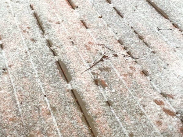
Snow (graupel) is falling in Vienna, VA and a quick dusting has already accumulated @capitalweather @ABC7Brian @MikeTFox5 pic.twitter.com/wbgSWhmgAS
— Brendan Pham (@WXStormGeek) February 22, 2021
Photo by Jessica Fadel on Unsplash
The D.C. metropolitan area, including Fairfax County, could get up to six inches of snow in a storm expected to arrive early tomorrow (Thursday) morning.
The region is now under a Winter Storm Warning, a step up from the Winter Storm Watch that the National Weather Service issued yesterday afternoon.
Issued at 10:24 a.m., the warning will take effect at 3 a.m. on Thursday and stay in place until 6 a.m. Friday. The NWS says there will be heavy snow mixed with sleet and freezing rain, forecasting three to six inches of snow and one-tenth to one-quarter inch of ice accumulation.
More details from the alert are below:
* WHEN…From 3 AM Thursday to 6 AM EST Friday. Snow will begin between 3 and 5 AM. Snow will change to a mixture of sleet and freezing rain during the late morning and early afternoon hours.
* IMPACTS…Power outages and tree damage are likely due to the ice. Travel could be nearly impossible. The hazardous conditions could impact the morning or evening commute.
* ADDITIONAL DETAILS…Snow Thursday morning will be heavy at times with snowfall rates around 1 to 2 inches per hour possible along with visibility reduced to around one-quarter mile at time.
Warning that the storm is expected to have “significant road impacts,” the Virginia Department of Transportation is advising residents to prepare to stay home and avoid nonessential travel tomorrow and on Friday.
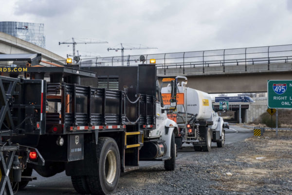
VDOT says its crews are finishing pretreatment of about 2,000 lane miles of interstates and primary roads in Northern Virginia. About 3,000 pieces of equipment will be ready tonight to treat roads, and plowing will start once two inches of snow have accumulated.
“Additional equipment and crews are on standby to report, including to handle downed trees or limbs from ice,” VDOT said in a news release.
The Fairfax County Fire and Rescue Department suggests testing smoke and carbon monoxide alarms to ensure they work, charging cell phones and tablets, and using a flashlight or other battery-powered device if power goes out.
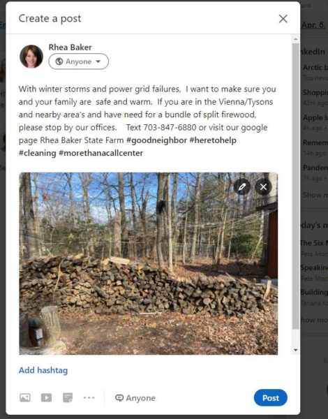
With communities elsewhere in the U.S. struggling to stay warm in frigid temperatures due to power outages, one Tysons resident is offering free firewood to anyone who needs it in the Tysons and Vienna area in advance of the coming winter storm.
“We had many trees taken down, and my husband took up chopping wood as a COVID project,” Rhea Baker told Tysons Reporter. “We personally do not have a working fireplace, so I have much more than I can use in my backyard fire pit.”
Baker, who works as an insurance agent with State Farm, says she also has ice scrapers that she is able to give away.
Staff photo by Jay Westcott, photo courtesy Rhea Baker
More snow is expected later this week.
The National Weather Service has issued a Winter Storm Watch for most of the region from late Wednesday night through late Thursday night.
Snow accumulations of five or more inches and total ice accumulations of more are possible.
More from the alert is below.
IMPACTS…Power outages and tree damage are likely due to the ice. Travel could be nearly impossible. The hazardous conditions could impact the morning or evening commute.
PRECAUTIONARY/PREPAREDNESS ACTIONS… Monitor the latest forecasts for updates on this situation.
Winter Storm Watches have been issued for the entire region for heavy wintry precipitation starting late Wednesday night and continuing through Thursday night. Visit https://t.co/ZOlvESgJ2H for more details. #DCwx #MDwx #VAwx #WVwx pic.twitter.com/ieYFLd2lqL
— NWS Baltimore-Washington (@NWS_BaltWash) February 16, 2021
Photo by Jessica Fadel on Unsplash
Fairfax County is now under an Ice Storm Warning after the National Weather Service upgraded the Winter Storm Watch it had put out for the D.C. area starting this morning.
Issued at 1:56 p.m., the ice storm warning will remain in effect until 7 a.m. tomorrow (Sunday). The NWS projects that the region will see 0.2-0.3 inches of sleet and freezing rain, which has been leaving roads slick with ice throughout the day.
“Roadways are becoming very icy and dangerous,” the NWS warns. “Avoid all unnecessary travel.”
This is the first time that an ice storm warning has been issued for the D.C. area since Feb. 12, 2008, according to Washington Post meterologist Matthew Cappucci.
The Virginia Department of Transportation is warning people to stay off the roads, noting that pavement could be slick even after it is treated.
The Fairfax County Park Authority announced at 2:19 p.m. that all of its facilities will close at 3:30 p.m., and all activities and programs scheduled after that time have been canceled for today. All activities on Fairfax County Public Schools grounds had already been suspended.
In the Tysons area, The Boro has canceled its scheduled Valentine’s drive-in movie screening of “Crazy, Stupid, Love” due to the inclement weather, though tomorrow’s screening of “Valentine’s Day” is expected to take place as planned.
Dominion Energy reported that ice damage to power lines is causing power outages in some areas.
The NWS advises anyone who must travel to take a flashlight, food, and water in case of an emergency. Power outages are also possible.
“When venturing outside, watch your first few steps taken on steps, sidewalks, and driveways, which could be icy and slippery, increasing your risk of a fall and injury,” the NWS said.
Offered without comment.
Actually no, we will comment. The roads are icy and it’s getting worse despite our continued treatment. Just pls #stayhome. We want you to be safe. pic.twitter.com/p4GDNYJupy
— VDOT Northern VA (@VaDOTNOVA) February 13, 2021
The weekend is nearly here, and in February 2021, that apparently means that Fairfax County is once again expected to get hit with a blast of frigid, even icy weather.
The National Weather Service issued a Winter Storm Watch for the D.C. region shortly after 6 p.m. last night. The alert will take effect tomorrow (Saturday) morning and last until 7 a.m. on Sunday (Feb. 14).
Here are more details from the alert:
…WINTER STORM WATCH IN EFFECT FROM SATURDAY MORNING THROUGH SUNDAY MORNING…
* WHAT…HEAVY ICING POSSIBLE. TOTAL SNOW ACCUMULATIONS OF UP TO ONE INCH AND ICE ACCUMULATIONS OF ONE QUARTER OF AN INCH POSSIBLE.
* WHERE…THE DISTRICT OF COLUMBIA, PORTIONS OF CENTRAL AND SOUTHERN MARYLAND AND NORTHERN VIRGINIA.
* WHEN…FROM SATURDAY MORNING THROUGH SUNDAY MORNING.
* IMPACTS…POWER OUTAGES AND TREE DAMAGE ARE POSSIBLE DUE TO THE ICE. TRAVEL COULD BE NEARLY IMPOSSIBLE.
A second message released today (Friday) at 8:36 a.m. reiterates that the watch is in effect from Saturday to Sunday morning and that there is “potential” for a quarter inch of ice or more to accumulate. However, it does not mention possible snow accumulation.
The NWS advises travelers to plan on slippery road conditions.
A Winter Storm Watch has been issued for Saturday and Saturday night for locations where significant icing from freezing rain is most likely. Outside of the watch, lesser amounts of ice will still likely result in travel difficulties. Check the latest at https://t.co/5RyZgoXicj pic.twitter.com/HxZ9M2tUNd
— NWS Baltimore-Washington (@NWS_BaltWash) February 11, 2021
Prepare for more snow in the region later tonight and into tomorrow.
The National Weather Service has issued a Winter Weather Advisory for most of the region. The advisory is in effect from 7 p.m. today through 10 a.m. tomorrow.
NWS expects snow accumulations of between one to three inches. More from the alert is below.
IMPACTS…Plan on slippery road conditions. The hazardous conditions could impact the morning or evening commute.
PRECAUTIONARY/PREPAREDNESS ACTIONS… Slow down and use caution while traveling.
When venturing outside, watch your first few steps taken on steps, sidewalks, and driveways, which could be icy and slippery increasing your risk of a fall and injury.
Winter Weather Advisories are now up for much of the area for tonight's winter storm. Generally looking at 2 to 4 inches of snow across the advisory area, with a light glaze of ice expected across central VA. pic.twitter.com/fIMrJu6rbB
— NWS Baltimore-Washington (@NWS_BaltWash) February 10, 2021
Winter Weather Advisory for Fairfax County beginning tonight(2-10) at 7 PM and ending Thursday at 10 AM. Currently 1 – 3 inches are expected. Be aware and be prepared. Remain weather aware and monitor updates throughout the day. #FCFRD #FFXSnow #WinterWeather #weather pic.twitter.com/8UMoNpuk74
— Fairfax County Fire/Rescue (@ffxfirerescue) February 10, 2021
Staff photo by Jay Westcott
The National Weather Service downgraded Fairfax County and the rest of the D.C. area from a Winter Storm Watch to a Winter Weather Advisory this morning.
As of 11:03 a.m., the NWS predicted that there could be up to an inch of additional snow accumulation by noon, resulting in one to three inches of total accumulation from today’s storm.
Here is more from the most recent alert:
…WINTER WEATHER ADVISORY REMAINS IN EFFECT UNTIL NOON EST
TODAY…* WHAT…Snow. Additional snow accumulations of up to one inch. Storm total snow of 1 to 3 inches.
* WHERE…Portions of The District of Columbia, central, northern and southern Maryland and central and northern Virginia.
* WHEN…Until noon EST today.
* IMPACTS…Plan on slippery road conditions.
PRECAUTIONARY/PREPAREDNESS ACTIONS…
Slow down and use caution while traveling.
When venturing outside, watch your first few steps taken on steps, sidewalks, and driveways, which could be icy and slippery, increasing your risk of a fall and injury.
Though the snow is expected to turn into rain this afternoon, the Fairfax County Office of Emergency Management advises shoveling snow from driveways and sidewalks to prevent it from refreezing when temperatures drop tonight.
[2/7/21 @ 9:30 AM] The NWS has downgraded Fairfax County to a Winter Weather Advisory until noon. It is important to shovel the snow from any driveway or sidewalk as soon as the snow stops this afternoon or it will refreeze overnight. #FFXSnow #WinterSafety pic.twitter.com/XcorGnbDqV
— Ready Fairfax (@ReadyFairfax) February 7, 2021
More snow may be on way as the previous week’s storm melts away.
The National Weather Service has issued a Winter Storm Watch for most of the region. The watch is in effect from late Saturday night through Sunday afternoon.
Heavy snow with total accumulations of five or more inches is possible.
More from the alert is below.
* WHERE…THE DISTRICT OF COLUMBIA, AND PORTIONS OF CENTRAL AND SOUTHERN MARYLAND, NORTHERN VIRGINIA, AND EASTERN WEST VIRGINIA.
* WHEN…FROM LATE SATURDAY NIGHT THROUGH SUNDAY AFTERNOON.
* IMPACTS…PLAN ON SLIPPERY ROAD CONDITIONS.
PRECAUTIONARY/PREPAREDNESS ACTIONS… MONITOR THE LATEST FORECASTS FOR UPDATES ON THIS SITUATION
Winter Weather Advisory Extended to 1 P.M. — The National Weather Service has extended its winter weather advisory for the D.C. area, including Fairfax County, to 1 p.m. today due to “lingering snow bands.” There could be up to two inches of snow accumulation, and slippery roads could make the morning commute hazardous. [NWS]
Metro to Change Lost-and-Found Policy, Citing Budget Constraints — “Beginning March 1, Metro’s lost and found department will work to reunite customers with lost wallets and electronics (such as phones, tablets, and laptops) only. All other items lost in the system will be disposed of, donated to charity, destroyed, or auctioned.” [WMATA]
Mosaic District Partners with Virginia Plunge Again — The Polar Plunge Festival is the signature annual fundraiser for Special Olympics Virginia. In past years, the Mosaic District has hosted the Plunge, but due to the pandemic, the usual in-person event has been replaced by a week of festivities, culminating in a virtual ceremony on Saturday (Feb. 6). Registration is now open. [Mosaic District/Twitter, Polar Plunge]
Tysons-Based Media Company Buys Sports Podcast Network — “Tegna wants a bigger piece of the podcast action: The TV station group announced the acquisition of Locked On Podcast Network, which produces some 160 daily shows for teams across the U.S.’s four major pro sports leagues and more than 30 colleges.” [Variety]
Justice High School Graduate Drafted by Washington Spirit — “When the Washington Spirit returns to the field this spring, local fans may spot a familiar face at forward–Falls Church native Anna Heilferty. After graduating from Boston University this winter, Heilferty was selected 19th overall by the Spirit in the 2021 National Women’s Soccer League Draft.” [Washingtonian]


