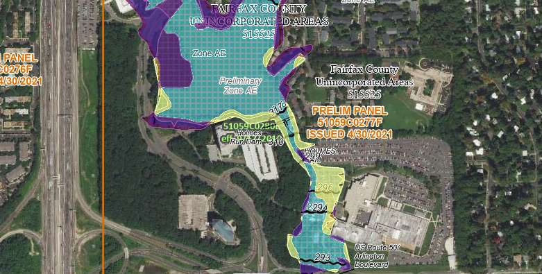
The parts of Fairfax County most at risk for flooding have shifted over the past 10-plus years, according to new flood insurance maps that are currently available for public review and appeals.
“Residents, business owners and other community partners are encouraged to review the updated maps to learn about local flood risks and potential future flood insurance requirements,” the Federal Emergency Management Agency said in a news release on Wednesday (April 27).
Recent Stories

Joon has expanded its offerings in Tysons with the addition of a bar and patio. Named after a poetic Farsi term for “wine,” May Bar began serving customers inside the…

Owners of six Woofie’s franchises in Northern Virginia are hosting a “Paws in the Park” pet adoption event tomorrow (Saturday) at Wolf Trap National Park. Participating Woofie’s include Reston/Herndon, Ashburn-Leesburg,…

A Fairfax Connector bus to Tysons (staff photo by James Jarvis) The Fairfax County Department of Transportation (FCDOT) has the green light to apply for a federal grant to replace…

The country band Delta Spur performs on the Plaza at Tysons Corner Center for the mall’s 2023 summer concert series (courtesy Tysons Corner Center) Fresh produce, good dogs and live…